place

A Once and Future Shoreline

Boston National Historical ParkCultural history of BostonLandmarks in BostonPublic art in MassachusettsSeashells in art
Detail, A Once and Future Shoreline

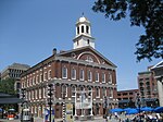
A Once and Future Shoreline is a permanent public artwork that graphically marks the edge of Boston Harbor, circa 1630, into the granite paving blocks of the plaza on the West side of the historic Faneuil Hall building. The 850-foot-long artwork depicts the location of a pre-colonial shoreline by graphically etching silhouettes of materials that are found typically along the high tide line. The artwork offers a way to engage the imagination in an exploration of the changes to this now urban site from a salty tidal marsh, to an active pedestrian plaza.

Excerpt from the Wikipedia article A Once and Future Shoreline (License: CC BY-SA 3.0, Authors, Images).

A Once and Future Shoreline
Faneuil Hall Square, Boston

Geographical coordinates (GPS) Address Website Nearby Places
placeShow on map

Wikipedia: A Once and Future ShorelineContinue reading on Wikipedia

Geographical coordinates (GPS)

Latitude Longitude
N 42.36 ° E -71.05625 °
placeShow on map

Address

Project Management Academy

Faneuil Hall Square 4
02109 Boston
Massachusetts, United States
mapOpen on Google Maps

Website
projectmanagementacademy.net

linkVisit website

Detail, A Once and Future Shoreline
Share experience

Nearby Places

Freedom Trail
Freedom Trail

The Freedom Trail is a 2.5-mile-long (4.0 km) path through Boston, Massachusetts, that passes by 16 locations significant to the history of the United States. Marked largely with brick, it winds from Boston Common in downtown Boston through the North End to the Bunker Hill Monument in Charlestown. Stops along the trail include simple explanatory ground markers, graveyards, notable churches and buildings, and a historic naval frigate. While most of the sites are free or suggest donations, the Old South Meeting House, the Old State House, and the Paul Revere House charge admission. The Freedom Trail is overseen by the City of Boston's Freedom Trail Commission and is supported in part by grants from various nonprofits and foundations, private philanthropy, and Boston National Historical Park. The Freedom Trail was conceived by local journalist William Schofield, who in 1951 suggested building a pedestrian trail to link important local landmarks. Boston mayor John Hynes decided to put Schofield's idea into action. By 1953, 40,000 people were walking the trail annually.The National Park Service operates a visitor's center on the first floor of Faneuil Hall, where they offer tours, provide free maps of the Freedom Trail and other historic sites, and sell books about Boston and United States history. Some observers have noted the tendency of the Freedom Trail's narrative frame to omit certain historical locations, such as the sites of the Boston Tea Party and the Liberty Tree.