place

Merchants Row (Boston)

Economic history of BostonFinancial District, BostonHistory of BostonStreets in Boston
StateSt Boston NYPL G90F328 032F detail

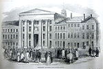
Merchants Row in Boston, Massachusetts is a short street extending from State Street to Faneuil Hall Square in the Financial District. Since the 17th century it has been a place of commercial activity. It sits close to Long Wharf and Dock Square, hubs of shipping and trade through the 19th century. Portions of the street were formerly known as Swing-Bridge Lane, Fish Lane, and Roebuck Passage.

Excerpt from the Wikipedia article Merchants Row (Boston) (License: CC BY-SA 3.0, Authors, Images).

Merchants Row (Boston)
Merchants Row, Boston

Geographical coordinates (GPS) Address Nearby Places
placeShow on map

Wikipedia: Merchants Row (Boston)Continue reading on Wikipedia

Geographical coordinates (GPS)

Latitude Longitude
N 42.359494444444 ° E -71.055708333333 °
placeShow on map

Address

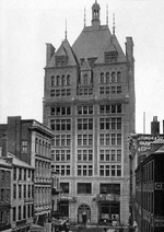
India Building

Merchants Row 10
02109 Boston
Massachusetts, United States
mapOpen on Google Maps

StateSt Boston NYPL G90F328 032F detail
Share experience

Nearby Places

Freedom Trail
Freedom Trail

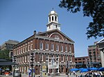
The Freedom Trail is a 2.5-mile-long (4.0 km) path through Boston, Massachusetts, that passes by 16 locations significant to the history of the United States. Marked largely with brick, it winds from Boston Common in downtown Boston through the North End to the Bunker Hill Monument in Charlestown. Stops along the trail include simple explanatory ground markers, graveyards, notable churches and buildings, and a historic naval frigate. While most of the sites are free or suggest donations, the Old South Meeting House, the Old State House, and the Paul Revere House charge admission. The Freedom Trail is overseen by the City of Boston's Freedom Trail Commission and is supported in part by grants from various nonprofits and foundations, private philanthropy, and Boston National Historical Park. The Freedom Trail was conceived by local journalist William Schofield, who in 1951 suggested building a pedestrian trail to link important local landmarks. Boston mayor John Hynes decided to put Schofield's idea into action. By 1953, 40,000 people were walking the trail annually.The National Park Service operates a visitor's center on the first floor of Faneuil Hall, where they offer tours, provide free maps of the Freedom Trail and other historic sites, and sell books about Boston and United States history. Some observers have noted the tendency of the Freedom Trail's narrative frame to omit certain historical locations, such as the sites of the Boston Tea Party and the Liberty Tree.