Grindley Brook
England river stubsExtremities of ShropshireRivers of ShropshireShropshire geography stubsVillages in Shropshire ... and 1 more
Whitchurch, Shropshire

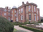
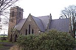
Grindley Brook is a small village in Shropshire, England, on the A41 trunk road around 1.5 miles north west of the market town of Whitchurch. It is the most northerly settlement in Shropshire and borders directly onto Cheshire, and is within the civil parish of Whitchurch Urban. It is also the name of a small brook which flows past the village and marks the Cheshire-Shropshire border at this point.
Excerpt from the Wikipedia article Grindley Brook (License: CC BY-SA 3.0, Authors, Images).Grindley Brook
Chester Road,
Geographical coordinates (GPS) Address Phone number Nearby Places Show on map
Geographical coordinates (GPS)
| Latitude | Longitude |
|---|---|
| N 52.982 ° | E -2.711 ° |
Address
Lockside Cafe
Chester Road
SY13 4QH , Whitchurch Urban
England, United Kingdom
Open on Google Maps


