place

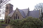
St Chad's Chapel, Tushingham

Chapels in EnglandCheshire West and ChesterChurch of England church buildings in CheshireChurches completed in 1691Diocese of Chester
Grade I listed churches in Cheshire
St Chad's, Tushingham

St Chad's Chapel (often referred to as Old St Chad's) is an isolated church in the scattered community of Tushingham in the civil parish of Tushingham-cum-Grindley, Macefen and Bradley, Cheshire, England. The only approach to the chapel is on footpaths across fields from the A41 road. It is recorded in the National Heritage List for England as a designated Grade I listed building.

Excerpt from the Wikipedia article St Chad's Chapel, Tushingham (License: CC BY-SA 3.0, Authors, Images).

St Chad's Chapel, Tushingham
Old Chads Lane,

Geographical coordinates (GPS) Address Nearby Places
placeShow on map

Wikipedia: St Chad's Chapel, TushinghamContinue reading on Wikipedia

Geographical coordinates (GPS)

Latitude Longitude
N 53.01178 ° E -2.7057 °
placeShow on map

Address

Old Chads Lane
SY13 4QS , Tushingham-cum-Grindley, Macefen and Bradley
England, United Kingdom
mapOpen on Google Maps

St Chad's, Tushingham
Share experience

Nearby Places

Macefen
Macefen

Macefen is a former civil parish, now in the parishes of Tushingham-cum-Grindley, Macefen and Bradley and No Man's Heath and District, in the unitary authority area of Cheshire West and Chester and the ceremonial county of Cheshire, England. Its area is now part of the civil parishes of Tushingham-cum-Grindley, Macefen and Bradley and No Man's Heath and District. Macefen lies 2 miles (3.2 km) east of the village of Malpas and 5 miles (8.0 km) north west of Whitchurch, Salop. Part of the village of No Man's Heath was within the northern boundary of Macefen. Its name is thought to possibly be an anglicisation of an older Welsh placename Maes-y-ffin, "the open field (maes) at the boundary (ffin)". Macefen was a slightly curious parish in that it scarcely appears in gazetteers. Under the manorial system Macefen was a manor of the Barony of Malpas, and was for many years part of the estates of the Grosvenor family. Later it was a township of the ancient parish of Malpas, in 1866 Macefen became a separate civil parish. Kelly's Directory of Cheshire, 1914 lists Macefen under Tushingham cum Grindley thus: "Macefen (or Maesfen) is a small township in the Whitchurch union, 2 miles south from Malpas station. The Hon. Mrs. Algernon R. Parker, who has a residence here [at grid reference SJ518466 on the north side of Bradley Lane], is lady of the manor and sole landowner." It never had its own church but was served by adjacent churches. The civil parish was abolished in 2015 to form "Tushingham-cum-Grindley, Macefen and Bradley" and "No Man's Heath and District".

No Man's Heath, Cheshire

No Man's Heath is a village in the unitary authority of Cheshire West and Chester and the ceremonial county of Cheshire, England. Its name has historically also been spelt Nomansheath and Noman's Heath, the latter being the version formerly favoured by the General Post Office. It lies 2 miles (3.2 km) east of the village of Malpas and 5 miles (8 km) north-west of Whitchurch, Shropshire. Originally on the A41 road, there is now a bypass, which opened in July 2001. Bickleywood is a very small settlement about 1000 yards (1 km) to the east. The settlement of No Man's Heath was, historically, largely within the boundaries of Macefen civil parish until 2015 boundary changes which created the civil parish of No Man's Heath and District. There is no church in the village, due to the proximity of the church in Tushingham. However, there are The Wheatsheaf Inn, a disused non-conformist chapel and a small telephone exchange (which was called "Noman's Heath" in the days when exchanges had names) in close proximity to one another. The southern section of the 30-mile Sandstone Trail footpath passes just east of the village, while the 200-mile Marches Way footpath passes just south. The Sustrans Regional Route 70 cycleway passes through the village, running out from Malpas. Just over two miles east of the village is the 19th-century Cholmondeley Castle and gardens. Just to the north is the well-preserved Iron Age hillfort of Maiden Castle, spectacularly sited above the Dee valley. The Whitchurch and Tattenhall Railway used to pass within a 1000 yards (a kilometre) of the village but the nearest station was Malpas railway station which was nearly three kilometres away and actually in Hampton Heath.