place

Burlington–Harmony Hill Roads Historic District

Colonial Revival architecture in ConnecticutGeography of Litchfield County, ConnecticutGeorgian architecture in ConnecticutHarwinton, ConnecticutHistoric districts on the National Register of Historic Places in Connecticut
NRHP infobox with nocatNational Register of Historic Places in Litchfield County, ConnecticutQueen Anne architecture in ConnecticutUse mdy dates from August 2023
BURLINGTON HARMONY HILL ROADS HISTORIC DISTRICT, LICHFIELD COUNTY, CT

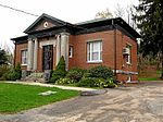
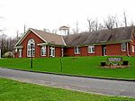
The Burlington–Harmony Hill Roads Historic District encompasses a historic rural agricultural crossroads village in eastern Harwinton, Connecticut. Stretching mainly along Harmony Hill Road north of its junction with Burlington Road, it includes residential buildings dating from the mid-18th to late 19th centuries. The district was listed on the National Register of Historic Places in 1996.

Excerpt from the Wikipedia article Burlington–Harmony Hill Roads Historic District (License: CC BY-SA 3.0, Authors, Images).

Burlington–Harmony Hill Roads Historic District
Harmony Hill Road,

Geographical coordinates (GPS) Address Nearby Places
placeShow on map

Wikipedia: Burlington–Harmony Hill Roads Historic DistrictContinue reading on Wikipedia

Geographical coordinates (GPS)

Latitude Longitude
N 41.775833333333 ° E -73.048888888889 °
placeShow on map

Address

Harmony Hill Road 37
06791
Connecticut, United States
mapOpen on Google Maps

BURLINGTON HARMONY HILL ROADS HISTORIC DISTRICT, LICHFIELD COUNTY, CT
Share experience

Nearby Places

East Litchfield Village, Connecticut

East Litchfield is an unincorporated village in the town of Litchfield, Litchfield County, Connecticut. The village of East Litchfield sits at the crossroads of the highways that connect Waterbury and Torrington; Hartford and Litchfield and the Naugatuck River that connects communities from Bridgeport to Winsted. East Litchfield, like Bantam, Milton and Northfield are parts of the town of Litchfield and have been since the town was settled in 1721. Over 3,000 years ago Native Americans found East Litchfield to be a hunting ground rich with wild game. They used the outcroppings of soapstone to make various vessels for food and drink. The area was also rich with quartz that was used for arrowheads and centuries later sent to Massachusetts for sandpaper production. When Europeans settled in the area it became a community of farmers and mill workers. Naugatuck Valley Railroad built a depot in 1849 and extended the train to Winsted. The mills along the Naugatuck River were able to load their freight and passengers could disembark at East Litchfield and get a stage coach to Litchfield center where they could take their summer retreats. Harwinton Fair attendees would take the train to and from East Litchfield where they would catch the shuttle to the Fair Grounds. Along the sides the Naugatuck River in East Litchfield were many mills; the Paige and Dains Paper Mill and Baldwin's Saw Mill were two. Ice was harvested from the Naugatuck River and stored in an icehouse built by the railroad company. After the establishment of the depot East Litchfield had a hotel and restaurant (Scovill House), a post office, blacksmith shop, harness shop, livery service to Litchfield center, Ferncliff Farm with a store and cheese factory, Mrs. Mark's variety store across from the depot, a chapel, one-room schoolhouse, icehouses, a baseball field, lumber mill, grist mill, cider mill and a paper factory. All of the above-mentioned business establishments disappeared after the depot closed; the chapel is still there and just a few of the original village homes.