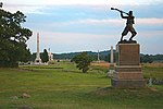
Gettysburg National Cemetery is a United States national cemetery created for Union casualties from the Battle of Gettysburg in the American Civil War. The Battle of Gettysburg, which was fought between July 1 to 3, 1863, resulted in the largest number of casualties of any Civil War battle but also was considered the war's turning point, leading ultimately to the Union victory.
Gettysburg National Cemetery is located just outside Gettysburg Borough to the south, in Adams County, Pennsylvania. The land was part of the Gettysburg Battlefield, and the cemetery is within Gettysburg National Military Park administered by the National Park Service of the United States Department of the Interior.Originally called Soldiers' National Cemetery, U.S. 16th President Abraham Lincoln (1809–1865, served 1861–1865), delivered his Gettysburg Address at the cemetery's consecration, November 19, 1863. That day is observed annually at the cemetery and in the town as
"Remembrance Day" with a parade/procession and memorial ceremonies by thousands of Civil War reenactor troops, both Union Army/United States Army and Confederate States Army and descendants heritage organizations led by the Sons of Union Veterans of the Civil War (SUVCW) and the Sons of Confederate Veterans (SCV).
The cemetery contains 3,512 interments from the Civil War, including the graves of 979 unknowns. It also has sections for veterans of the Spanish–American War (1898), World War I (1917–1918), and other wars, along with graves of the veterans' spouses and children. The total number of interments exceeds 6,000.Battlefield monuments, memorials, and markers are scattered throughout the cemetery, and its stone walls, iron fences and gates, burial and section markers, and brick sidewalk are listed as contributing structures within Gettysburg Battlefield Historic District.


