Cemetery Ridge
Gettysburg BattlefieldHistoric district contributing properties in PennsylvaniaLandforms of Adams County, PennsylvaniaNRHP infobox with nocatNational Register of Historic Places in Adams County, Pennsylvania ... and 1 more
Ridges of Pennsylvania

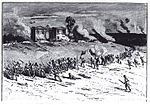
Cemetery Ridge is a geographic feature in Gettysburg National Military Park, south of the town of Gettysburg, Pennsylvania, that figured prominently in the Battle of Gettysburg, July 1 to July 3, 1863. It formed a primary defensive position for the Union Army during the battle, roughly the center of what is popularly known as the "fish-hook" line. The Confederate States Army launched attacks on the Union positions on the second and third days of the battle, but were driven back both times.
Excerpt from the Wikipedia article Cemetery Ridge (License: CC BY-SA 3.0, Authors, Images).Cemetery Ridge
Taneytown Road,
Geographical coordinates (GPS) Address Nearby Places Show on map
Geographical coordinates (GPS)
| Latitude | Longitude |
|---|---|
| N 39.818056 ° | E -77.2325 ° |
Address
Taneytown Road 198
17325
Pennsylvania, United States
Open on Google Maps


