place

Richard P. Braun Bridge

1985 establishments in MinnesotaBridges completed in 1985Bridges completed in 1999Bridges in Hennepin County, MinnesotaBridges over the Mississippi River
Concrete bridges in the United StatesGirder bridges in the United StatesMidwestern United States bridge (structure) stubsMinnesota building and structure stubsMinnesota transportation stubsRoad bridges in MinnesotaTransportation buildings and structures in Anoka County, Minnesota
RichardPBraunBridge
RichardPBraunBridge

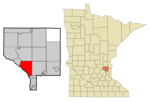
Richard P. Braun Bridge is a pair of 10-span concrete girder bridges spanning the Mississippi River between Brooklyn Park, Minnesota and Coon Rapids, Minnesota. The eastbound span was built in 1985 to connect Minnesota State Highway 252 with Minnesota State Highway 610 in Coon Rapids. The westbound span was built in 1999 as part of the continued construction of Highway 610 through Brooklyn Park. Richard P. Braun is a former Mn/DOT Commissioner from 1979 to 1986. There is a walkway on the south side of the bridge that connects a trail along West River Road in Brooklyn Park with a trail along the east side of the river in Coon Rapids. The trail on the east side leads to the Coon Rapids Dam, about a mile and a half north.

Excerpt from the Wikipedia article Richard P. Braun Bridge (License: CC BY-SA 3.0, Authors, Images).

Richard P. Braun Bridge
MN 610,

Geographical coordinates (GPS) Address External links Nearby Places
placeShow on map

Wikipedia: Richard P. Braun BridgeContinue reading on Wikipedia

Geographical coordinates (GPS)

Latitude Longitude
N 45.129151 ° E -93.298918 °
placeShow on map

Address

Richard P. Braun Bridge

MN 610
55444
Minnesota, United States
mapOpen on Google Maps

linkWikiData (Q7328224)
linkOpenStreetMap (707117277)

RichardPBraunBridge
RichardPBraunBridge
Share experience

Nearby Places

Coon Rapids–Foley Boulevard station

Coon Rapids–Foley Boulevard is a planned infill station on the Northstar commuter rail line in Coon Rapids, Minnesota, United States, at the site of a current Metro Transit park and ride facility. The station was originally included in Northstar plans, but it was cut in order to meet the Federal Transit Administration's cost-effectiveness index (CEI).The current park-and-ride facility is located on a sliver of land in between Minnesota State Highway 610 and Foley Boulevard. It has 3,200 parking spaces with a surface lot and a two-story parking ramp, giving it more than four times the capacity of the largest existing Northstar station, Elk River (754 spaces). Despite the fact that it already existed and would be a significant source of riders, calculation of the cost-effectiveness index was biased toward saving time of commuters. Riders would not save enough time by changing from the existing bus service to rail, so the station was dropped.Anoka County and the city of Coon Rapids have been acquiring land and making arrangements for matching funds for the station. It is expected to cost approximately $15 million to build the station. Construction will likely occur along with a related project to add a third set of rails along this stretch of track, which is the busiest in Minnesota. The third main line will allow additional passenger rail traffic, including the proposed Northern Lights Express project to connect to Duluth. The station will serve both lines, since it is nicely located just south of Coon Creek Junction where the BNSF Hinckley Subdivision branches off of the Staples Subdivision main line.