place

Pawtuckaway Lake

Lakes of Rockingham County, New HampshireNew Hampshire placenames of Native American originNottingham, New Hampshire
Pawtuckaway Lake
Pawtuckaway Lake

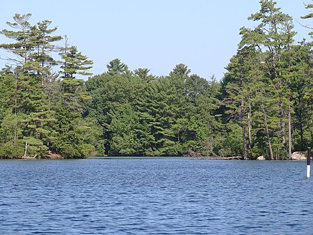
Pawtuckaway Lake (official name Pawtuckaway Pond) is a 784-acre (3.17 km2) reservoir in Rockingham County in southeastern New Hampshire, United States, in the town of Nottingham. The lake is located in the Piscataqua River drainage basin. The lake presently has two dams and three dikes. The dam on the southern end of the lake, Dolloff Dam, feeds the Pawtuckaway River, which flows southeast to the Lamprey River in the western part of the town of Epping. The dam at the north end of the lake, Drown's Dam, releases water to the Bean River, leading to the North River and ultimately the Lamprey River in the northern part of Epping. Approximately half of the lake's shoreline consists of private homes with a mixture of seasonal and year-round residents. Most of the western side of Pawtuckaway Lake is occupied by Pawtuckaway State Park, a popular camping, swimming, boating, hiking, bouldering, and orienteering destination. Canoe orienteering events are held on the lake.

Excerpt from the Wikipedia article Pawtuckaway Lake (License: CC BY-SA 3.0, Authors, Images).

Pawtuckaway Lake
Barderry Lane,

Geographical coordinates (GPS) Address Nearby Places
placeShow on map

Wikipedia: Pawtuckaway LakeContinue reading on Wikipedia

Geographical coordinates (GPS)

Latitude Longitude
N 43.088888888889 ° E -71.138611111111 °
placeShow on map

Address

Barderry Lane

Barderry Lane
03290
New Hampshire, United States
mapOpen on Google Maps

Pawtuckaway Lake
Pawtuckaway Lake
Share experience

Nearby Places

Dame School
Dame School

The Dame School is a historic meeting house, school, and now local historical museum, on New Hampshire Route 152 in Nottingham, New Hampshire. The single story wood-frame Greek Revival structure was built in 1840 as a church; according to local legend, timbers from a 1740 church were used in its construction. Its main facade has a simple entrance topped by a transom window, and flanked by a pair of windows. The building is topped by a three-stage tower, whose second stage houses a belfry, and whose spire is topped by a weathervane in the shape of a quill pen. It was used as a meeting house until about 1878, with its dual use as a school beginning c. 1870. It was dedicated for academic use in 1878, after the local Universalist congregation which had been using for services, built its own dedicated building. This building is said to have acquired its distinctive weathervane as a gift in 1870 from schoolmaster Bartholomew Van Dame.The building was moved closer to the center in 1952, at which time it was mounted on a concrete foundation, and a sympathetic addition was made to increase its capacity. In 1995 a new central elementary school was built, and the addition was converted for use as a police station. This building was again moved to provide parking space for the police, and has been adapted for use as a local history museum and community center.The building was listed on the National Register of Historic Places in 1980.