place

Thames Ditton Foundry

Buildings and structures demolished in 1976Companies established in 1874Demolished buildings and structures in EnglandFoundries in the United Kingdom
Brock Burton Royalty

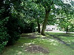
The Thames Ditton Foundry was a foundry in Thames Ditton, Surrey, which operated from 1874 to 1939 and which under various owners produced numerous major statues and monuments as one of the United Kingdom's leading firms of bronze founders.

Excerpt from the Wikipedia article Thames Ditton Foundry (License: CC BY-SA 3.0, Authors, Images).

Thames Ditton Foundry
Summer Road, Elmbridge Thames Ditton

Geographical coordinates (GPS) Address Nearby Places
placeShow on map

Wikipedia: Thames Ditton FoundryContinue reading on Wikipedia

Geographical coordinates (GPS)

Latitude Longitude
N 51.3932 ° E -0.3332 °
placeShow on map

Address

Summer Road

Summer Road
KT7 0QJ Elmbridge, Thames Ditton
England, United Kingdom
mapOpen on Google Maps

Brock Burton Royalty
Share experience

Nearby Places

River Mole
River Mole

The River Mole is a tributary of the River Thames in southern England. It rises in West Sussex near Gatwick Airport and flows northwest through Surrey for 80 km (50 miles) to the Thames at Hampton Court Palace. The river gives its name to the Surrey district of Mole Valley. The Mole crosses the North Downs between Dorking and Leatherhead, where it cuts a steep-sided valley, known as the Mole Gap, through the chalk. Much of the catchment area lies on impermeable rock (including Weald Clay and London Clay), meaning that the river level responds rapidly to heavy rainfall.During the second half of the 20th century pollution levels in the river were high; however, since 1995 the water quality has improved dramatically and the Mole now boasts the greatest diversity of fish species of any river in England. Twelve Sites of Special Scientific Interest (SSSIs) that include wetland habitats are located within the Mole catchment area, and the stretch of river through Leatherhead has been designated a Local Nature Reserve. The Mole Gap forms part of a Special Area of Conservation and is an SSSI of European importance.The river has captured the imagination of several authors and poets, particularly since in very hot summers the river channel can become dry between Dorking and Leatherhead, most recently in 2022. In John Speed's 1611 map of Surrey this stretch of the river is denoted by a series of hills accompanied by the legend "The river runneth under". However the river's name is unlikely to have derived from this behaviour: The Oxford Dictionary of English Place Names suggests that Mole either comes from the Latin mola (a mill) or is a back-formation from Molesey (Mul's island). Domesday Book lists twenty mills on the river in 1086, of which Sidlow Mill was the oldest, dating from Saxon times.