Ashton-under-Lyne is a market town in Tameside, Greater Manchester, England. The population was 45,198 at the 2011 census. Historically in Lancashire, it is on the north bank of the River Tame, in the foothills of the Pennines, 6.2 miles (10.0 km) east of Manchester.
Evidence of Stone Age, Bronze Age, and Viking activity has been discovered in Ashton-under-Lyne. The "Ashton" part of the town's name probably dates from the Anglo-Saxon period, and derives from Old English meaning "settlement by ash trees". The origin of the "under-Lyne" suffix is less clear; it possibly derives from the Brittonic-originating word lemo meaning elm or from Ashton's proximity to the Pennines. In the Middle Ages, Ashton-under-Lyne was a parish and township and Ashton Old Hall was held by the de Asshetons, lords of the manor. Granted a royal charter in 1414, the manor spanned a rural area consisting of marshland, moorland, and a number of villages and hamlets.
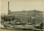
Until the introduction of the cotton trade in 1769, Ashton was considered "bare, wet, and almost worthless". The factory system, and textile manufacture during the Industrial Revolution triggered a process of unplanned urbanisation in the area, and by the mid-19th century Ashton had emerged as an important mill town at a convergence of newly constructed canals and railways. Ashton-under-Lyne's transport network allowed for an economic boom in cotton spinning, weaving, and coal mining, which led to the granting of municipal borough status in 1847.
In the mid-20th century, imports of cheaper foreign goods led to the decline of Ashton's heavy industries but the town has continued to thrive as a centre of commerce and Ashton Market is one of the largest outdoor markets in the United Kingdom. Ashton Town Centre is now home to the 140,000-square-foot (13,000 m2), two-floored Ashton Arcades shopping centre (opened 1995), the outdoor shopping complex Ladysmith Shopping Centre, and a large IKEA store.
In 2018, a large new development opened in Ashton town centre including a new college campus for Tameside College, new council offices and a library. Improvements were also made to the open-air market, including new kiosks and stalls. In 2019, work began on a brand-new transport interchange for the town centre to make getting into the town much easier via bus and Metrolink. This opened in August 2020.


