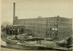
Dukinfield and Ashton railway station
Dukinfield and Ashton railway station served Dukinfield in Greater Manchester, England. The station was built at high level on a viaduct as it passed directly above Alma Bridge, King Street, Dukinfield. Access to the platforms was via an entrance in Cooper Street and ascending a staircase inside one of viaduct pillars. The viaduct extended from Whiteland, Ashton under Lyne, transversed the Tame Valley, passing over Crescent Road, King Street, Wharf Street, Charles Street and the Peak Forrest Canal before plunging under the Old Great Central line at Guide Bride and emerging at Audenshaw (Hooley Hill). The station was opened on 2 October 1893 by the London and North Western Railway, and was closed on 25 September 1950 by British Railways.
Excerpt from the Wikipedia article Dukinfield and Ashton railway station (License: CC BY-SA 3.0, Authors).Dukinfield and Ashton railway station
Cooper Street, Tameside
Geographical coordinates (GPS) Address Nearby Places Show on map
Geographical coordinates (GPS)
| Latitude | Longitude |
|---|---|
| N 53.482585 ° | E -2.094041 ° |
Address
Cooper Street
Cooper Street
SK16 4JB Tameside
England, United Kingdom
Open on Google Maps


