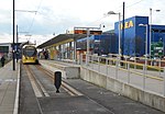
Tameside

The Metropolitan Borough of Tameside is a metropolitan borough of Greater Manchester in England. It is named after the River Tame, which flows through the borough, and includes the towns of Ashton-under-Lyne, Audenshaw, Denton, Droylsden, Dukinfield, Hyde, Mossley and Stalybridge. Its western border is approximately 4 miles (6.4 km) east of Manchester city centre. Tameside is bordered by the metropolitan boroughs of Stockport and Oldham to the south and north respectively, the city of Manchester to the west and the borough of High Peak in Derbyshire to the east across Longdendale. As of 2011 the overall population was 219,324. It is also the 8th-most populous borough of Greater Manchester by population.The history of the area extends back to the Stone Age. There are over 300 listed buildings in Tameside and three Scheduled Ancient Monuments, which includes a castle of national importance. The settlements in Tameside were small townships centred on agriculture until the advent of the Industrial Revolution. The towns of the borough grew and became involved in the cotton industry, which dominated the local economy. The current borough was created in 1974 as part of the provisions of the Local Government Act 1972.
Excerpt from the Wikipedia article Tameside (License: CC BY-SA 3.0, Authors, Images).Tameside
Heinemannstraße, Bonn Hochkreuz
Geographical coordinates (GPS) Address Nearby Places Show on map
Geographical coordinates (GPS)
| Latitude | Longitude |
|---|---|
| N 53.49 ° | E -2.0941666666667 ° |
Address
Eisenbahn-Bundesamt
Heinemannstraße 6
53175 Bonn, Hochkreuz
Nordrhein-Westfalen, Deutschland
Open on Google Maps


