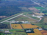
Emergency Government Headquarters

Emergency Government Headquarters is the name given for a system of nuclear fallout shelters built by the Government of Canada in the 1950s and 1960s as part of continuity of government planning at the height of the Cold War. Situated at strategic locations across the country, the largest of these shelters are popularly referred to as "Diefenbunkers", a nickname coined by federal opposition politicians during the early 1960s. The nickname was derived from the last name of the Prime Minister of the day, John Diefenbaker, who authorized their construction. Over fifty facilities were built along several designs for various classes of service. Most of these facilities were built, often in great secrecy, at rural locations outside major cities across Canada. The majority of the larger facilities were two-story underground bunkers while the largest at CFS Carp had four floors; these facilities were designed to withstand a near-miss from a nuclear explosion. Each underground facility had entrances through massive blast doors at the surface, as well as extensive air filters and positive air pressure to prevent radiation infiltration. Underground storage was built for food, fuel, fresh water, and other supplies for the facilities which were capable of supporting several dozen people for a period of several weeks. The facilities were operated by personnel from the Royal Canadian Corps of Signals, renamed to Communications Command after the 1968 unification of the Canadian Armed Forces.
Excerpt from the Wikipedia article Emergency Government Headquarters (License: CC BY-SA 3.0, Authors, Images).Emergency Government Headquarters
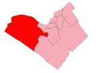
Craig's Side Road, Ottawa West Carleton-March (West Carleton)
Geographical coordinates (GPS) Address Nearby Places Show on map
Geographical coordinates (GPS)
| Latitude | Longitude |
|---|---|
| N 45.35169 ° | E -76.0499409 ° |
Address
Ball Diamond
Craig's Side Road
K0A 1L0 Ottawa, West Carleton-March (West Carleton)
Ontario, Canada
Open on Google Maps


