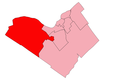
Kanata—Carleton
2013 establishments in OntarioCanElecResTopTest with bare yearFederal electoral districts of OttawaOntario federal electoral districtsUse mdy dates from November 2021

Kanata—Carleton is a federal electoral district in Ottawa, Ontario.Kanata—Carleton was created by the 2012 federal electoral boundaries redistribution and was legally defined in the 2013 representation order. It came into effect upon the call of the 2015 federal election. The new riding contains almost all of the portion of the former Carleton—Mississippi Mills located in Ottawa, except for the portion south of Highway 7/Highway 417 that transferred to Carleton. A small fraction came from Nepean—Carleton surrounding the Bridlewood neighbourhood.
Excerpt from the Wikipedia article Kanata—Carleton (License: CC BY-SA 3.0, Authors, Images).Kanata—Carleton
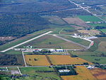
Thomas A. Dolan Parkway, Ottawa West Carleton-March (West Carleton)
Geographical coordinates (GPS) Address Nearby Places Show on map
Geographical coordinates (GPS)
| Latitude | Longitude |
|---|---|
| N 45.371 ° | E -76.097 ° |
Address
Thomas A. Dolan Parkway
Thomas A. Dolan Parkway
Ottawa, West Carleton-March (West Carleton)
Ontario, Canada
Open on Google Maps


