place

West Carleton Township

1974 establishments in OntarioFormer municipalities now in OttawaFormer township municipalities in OntarioOttawa stubsPopulated places disestablished in 2000

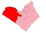
West Carleton was a township municipality in Eastern Ontario, Canada. It was located in the rural parts of what is now the City of Ottawa, west of Kanata. Its northern boundary was the Ottawa River. The township was created in 1974 with the amalgamation of three townships: Torbolton, Fitzroy, and Huntley. In 2001 it was amalgamated with Cumberland, Gloucester, Goulbourn, Kanata, Nepean, Osgoode, Ottawa, Rideau, Rockcliffe Park and Vanier to form the new city of Ottawa. According to the Canada 2016 Census: Population: 21,547 % Change (2011–2016): +6.2% Dwellings: 8,596 Area (km²): 630.95 Density (persons per km²): 34.2

Excerpt from the Wikipedia article West Carleton Township (License: CC BY-SA 3.0, Authors).

West Carleton Township
Thomas A. Dolan Parkway, Ottawa West Carleton-March (West Carleton)

Geographical coordinates (GPS) Address Nearby Places
placeShow on map

Wikipedia: West Carleton TownshipContinue reading on Wikipedia

Geographical coordinates (GPS)

Latitude Longitude
N 45.366666666667 ° E -76.1 °
placeShow on map

Address

Thomas A. Dolan Parkway

Thomas A. Dolan Parkway
Ottawa, West Carleton-March (West Carleton)
Ontario, Canada
mapOpen on Google Maps

Share experience

Nearby Places

Emergency Government Headquarters

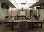
Emergency Government Headquarters is the name given for a system of nuclear fallout shelters built by the Government of Canada in the 1950s and 1960s as part of continuity of government planning at the height of the Cold War. Situated at strategic locations across the country, the largest of these shelters are popularly referred to as "Diefenbunkers", a nickname coined by federal opposition politicians during the early 1960s. The nickname was derived from the last name of the Prime Minister of the day, John Diefenbaker, who authorized their construction. Over fifty facilities were built along several designs for various classes of service. Most of these facilities were built, often in great secrecy, at rural locations outside major cities across Canada. The majority of the larger facilities were two-story underground bunkers while the largest at CFS Carp had four floors; these facilities were designed to withstand a near-miss from a nuclear explosion. Each underground facility had entrances through massive blast doors at the surface, as well as extensive air filters and positive air pressure to prevent radiation infiltration. Underground storage was built for food, fuel, fresh water, and other supplies for the facilities which were capable of supporting several dozen people for a period of several weeks. The facilities were operated by personnel from the Royal Canadian Corps of Signals, renamed to Communications Command after the 1968 unification of the Canadian Armed Forces.

Diefenbunker
Diefenbunker

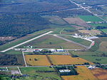
The Diefenbunker, formerly known by its military designation, Canadian Forces Station Carp (CFS Carp), is a large underground four-storey reinforced concrete bunker and nuclear fallout shelter located in the rural area of Carp, Ontario approximately 30 km (19 mi) west of downtown Ottawa. Between 1957 and 1961, during the Cold War the Government of Canada led by then Prime Minister John Diefenbaker authorized the Diefenbunker to be designed and built as the Central Emergency Government Headquarters (CEGHQ Carp) in an attempt to ensure the continuity of government subsequent to a nuclear weapons attack by the Soviet Union. In 1994, CFS Carp was decommissioned and closed.In 1994, the Diefenbunker was designated a National Historic Site of Canada because it is considered the most important surviving Cold War site in Canada. The bunker is important as an engineering achievement and to the critical path method of planning used in its construction. In addition, the Diefenbunker is symbolic of the Cold War, a strategy of nuclear deterrence and the Canadian people's determination to survive as a nation following a nuclear war. The Historic Sites and Monuments Board of Canada (HSMBC) plaque located at the Diefenbunker states: Irreverently known as the "Diefenbunker," this structure is a powerful symbol of Canada's response to the Cold War. Designed in the 1950s to withstand all but a direct hit by a nuclear weapon, it was intended to shelter key political and military personnel during a nuclear attack. Fortunately, it never served its intended purpose, although the Diefenbaker government made plans to retreat to its protection during the Cuban missile crisis of 1962. The bunker functioned as the hub of a communications network and civil defence system until it closed in 1994. In 1998, the facility was re-opened as a museum called the "Diefenbunker: Canada's Cold War Museum" allowing the general public year-round access to tour the facility.