Eider Canal
1784 establishments in DenmarkBodies of water of Schleswig-HolsteinCanals in GermanyCanals opened in 1784Eider basin ... and 4 more
Kiel CanalKiel Canal basinShip canalsTransport in Kiel

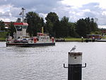
The Eider Canal (also called the Schleswig-Holstein Canal) was an artificial waterway in southern Denmark (later northern Germany) which connected the North Sea with the Baltic Sea by way of the rivers Eider and Levensau. Constructed between 1777 and 1784, the Eider Canal was built to create a path for ships entering and exiting the Baltic that was shorter and less storm-prone than navigating around the Jutland peninsula. In the 1880s the canal was replaced by the enlarged Kiel Canal, which includes some of the Eider Canal's watercourse.
Excerpt from the Wikipedia article Eider Canal (License: CC BY-SA 3.0, Authors, Images).Eider Canal
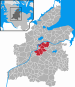
Sehestedter Straße, Eiderkanal
Geographical coordinates (GPS) Address Nearby Places Show on map
Geographical coordinates (GPS)
| Latitude | Longitude |
|---|---|
| N 54.3435 ° | E 9.8298 ° |
Address
Bovenau Kluvensieker Schleuse
Sehestedter Straße
24796 Eiderkanal
Schleswig-Holstein, Germany
Open on Google Maps

