Bovingdon
BovingdonCivil parishes in HertfordshireDacorumEngvarB from May 2016Villages in Hertfordshire

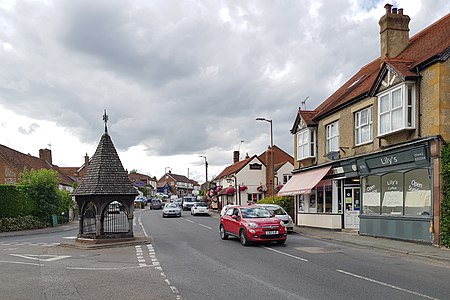
Bovingdon is a village in Hertfordshire, England, 4 miles (6.4 km) southwest of Hemel Hempstead, and it is a civil parish within the local authority area of Dacorum. It forms the largest part of the ward of Bovingdon, Flaunden and Chipperfield, which had a population of 4,600 at the 2001 census, increasing to 9,000 at the 2011 Census.
Excerpt from the Wikipedia article Bovingdon (License: CC BY-SA 3.0, Authors, Images).Bovingdon
Chesham Road, Dacorum
Geographical coordinates (GPS) Address Nearby Places Show on map
Geographical coordinates (GPS)
| Latitude | Longitude |
|---|---|
| N 51.72312 ° | E -0.5367 ° |
Address
Chesham Road
Chesham Road
HP3 0EA Dacorum
England, United Kingdom
Open on Google Maps


