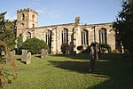
Calverton, Nottinghamshire

Calverton () is a village and civil parish in Nottinghamshire, of some 3,300 acres (1,300 ha), in the Gedling district, about 7 miles north-east of Nottingham, and 10 miles south-east of Mansfield. England, and situated, like nearby Woodborough and Lambley, on one of the small tributaries of the Dover Beck. The 2011 census found 7,076 inhabitants in 2,987 households. About two miles to the north of the village is the site of the supposed deserted settlement of Salterford. The parish is bounded on the south-east by Woodborough, to the south-west by Arnold, Papplewick and Ravenshead, to the north by Blidworth, and to the north-east by Oxton and Epperstone.During most of its existence Calverton was a forest village, in that part of Sherwood known as Thorney Wood Chase, with a rural economy limited by a lack of grazing land, in which handicrafts (like woodworking and the knitting of stockings), must in consequence have assumed a more than usual importance. The parliamentary enclosure of 1780 brought some agrarian progress to the village, but it was not until the opening of a colliery by the National Coal Board in 1952, that the village began to assume its present identity, with new housing estates and marked population growth. The colliery closed in 1999 and while a small industrial estate provides some local employment, Calverton has taken on the character of a large commuter village. In May 1974 the village was officially twinned with Longué-Jumelles, in the Loire valley of France.
Excerpt from the Wikipedia article Calverton, Nottinghamshire (License: CC BY-SA 3.0, Authors, Images).Calverton, Nottinghamshire
Main Street, Gedling
Geographical coordinates (GPS) Address Nearby Places Show on map
Geographical coordinates (GPS)
| Latitude | Longitude |
|---|---|
| N 53.037 ° | E -1.083 ° |
Address
Oscar's
Main Street
NG14 6FB Gedling
England, United Kingdom
Open on Google Maps


