Cradley, Herefordshire

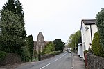
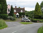
Cradley () is a village in the civil parish of Cradley and Storridge, in Herefordshire, England. The nearest Herefordshire to Cradley towns are Ledbury, 9 miles (14 km) to the south and Bromyard, 9 miles to the north-west. The Worcestershire town of Malvern is 4 miles (6 km) to the south-east on the farther side of the Malvern Hills. Cradley and Storridge parish had a 2011 population of 1,667. On 12 October 2018 the parish was renamed from "Cradley" to "Cradley & Storridge".Cradley village hall is a 16th-century timbered building, which was renovated and restored after a fire destroyed a large part of the roof. It has 21st-century additions of meeting rooms, and is a heritage and village resource centre. Used for research into local history and genealogy, it has computer, printing and copying services. Since the closure of the combined village shop and post office, a post office counter with usual services is part of the village hall. A new village stores opened in 2022.The parish church is dedicated to St James. The chancel was added by Sir George Gilbert Scott in 1868. Pevsner also mentions a mediaeval lychgate, a font dated 1722 and the remains of a previous carved font incorporated into a doorway in the tower. Carved stones in the fabric of the church have been identified as dating from the Saxon period.The "Three Villages Festival" celebrates the rural Herefordshire life of the villages of Cradley, Storridge and Mathon. In 2011, the event's theme was "Masquerade", an exploration of mask making and wearing.
Excerpt from the Wikipedia article Cradley, Herefordshire (License: CC BY-SA 3.0, Authors, Images).Cradley, Herefordshire
Rectory Lane,
Geographical coordinates (GPS) Address Nearby Places Show on map
Geographical coordinates (GPS)
| Latitude | Longitude |
|---|---|
| N 52.122 ° | E -2.3877 ° |
Address
Rectory Lane
WR13 5LH , Cradley
England, United Kingdom
Open on Google Maps


