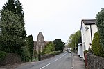
End Hill
Hills of WorcestershireMalvern, WorcestershireMalvern HillsUse British English from September 2019Worcestershire geography stubs

End Hill is the northernmost top of the Malvern Hills that runs approximately 13 kilometres (8 mi) north-south along the Herefordshire-Worcestershire border. It lies north of Table Hill and north-northwest of North Hill. It has an elevation of 329 metres (1,079 ft).
Excerpt from the Wikipedia article End Hill (License: CC BY-SA 3.0, Authors, Images).End Hill
Lady Howard De Walden Drive, Malvern Hills
Geographical coordinates (GPS) Address Nearby Places Show on map
Geographical coordinates (GPS)
| Latitude | Longitude |
|---|---|
| N 52.119561111111 ° | E -2.3415666666667 ° |
Address
Lady Howard De Walden Drive
WR14 4AY Malvern Hills
England, United Kingdom
Open on Google Maps


