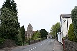
Sugarloaf Hill, Malvern
Hills of WorcestershireMalvern, WorcestershireMalvern HillsMarilyns of EnglandUse British English from September 2019

Sugarloaf Hill lies between the Worcestershire Beacon and North Hill in the range of Malvern Hills that runs about 13 kilometres (8 mi) north-south along the Herefordshire-Worcestershire border. The summit of Sugarloaf Hill is 368 metres (1,207 ft) above sea level and is a popular peak usually passed by walkers hiking between the Worcestershire Beacon and North Hill—respectively the highest and second highest Malvern Hills summits.
Excerpt from the Wikipedia article Sugarloaf Hill, Malvern (License: CC BY-SA 3.0, Authors, Images).Sugarloaf Hill, Malvern
Lady Howard De Walden Drive, Malvern Hills North Malvern
Geographical coordinates (GPS) Address Nearby Places Show on map
Geographical coordinates (GPS)
| Latitude | Longitude |
|---|---|
| N 52.1099 ° | E -2.3416 ° |
Address
Lady Howard De Walden Drive
WR14 4RF Malvern Hills, North Malvern
England, United Kingdom
Open on Google Maps


