place

Downs Light Railway

Children's railwaysMiniature railways in the United KingdomRail transport in HerefordshireRailway lines opened in 1925Use British English from August 2017

The Downs Light Railway is the world's oldest private miniature railway, with a track gauge of 9+1⁄2 in (241 mm). The railway is located within the grounds of The Downs Malvern, a private school in Colwall, near the town of Malvern, Worcestershire in the English Midlands. It is owned by the Downs Light Railway Trust. The Downs Light Railway is maintained and operated principally by the school children, aged between 7 and 13 years. It provides a wide range of educational and regular extra-curricular activities, and supports other local schools. After reappraising the Downs Light Railway Trust's public benefit requirements, activities extended to young people from the community at large. As of 2019, it is part of the Heritage Railway Association membership.

Excerpt from the Wikipedia article Downs Light Railway (License: CC BY-SA 3.0, Authors).

Downs Light Railway
Brockhill Road,

Geographical coordinates (GPS) Address Phone number Website Nearby Places
placeShow on map

Wikipedia: Downs Light RailwayContinue reading on Wikipedia

Geographical coordinates (GPS)

Latitude Longitude
N 52.08731 ° E -2.352882 °
placeShow on map

Address

The Downs, Malvern College Prep School

Brockhill Road
WR13 6EY
England, United Kingdom
mapOpen on Google Maps

Phone number

call+441684544100

Website
thedownsmalvern.org.uk

linkVisit website

Share experience

Nearby Places

Colwall Park Racecourse

Colwall Park Racecourse was a British horse racing venue which operated from 1900 to 1939. It was known as one of England’s prettiest racecourses.The course was designed by journalist and National Hunt fan, Frederick Page, as a left-handed, mainly flat steeplechase course of one and a half miles. It had eight fences, including two ditches and a water jump. There was also a one-mile hurdle course. There was a slight rise on the far side of the course and a run-in of 400 yards.The course was situated at Brook Farm on the Barton Court Estate, near to the village railway station and was established by Roland Cave-Brown-Cave, a local man who had married the widowed daughter of the estate's owners. He built the nearby hotel, which still exists. The first meeting was held on Thursday 10 May 1900. Meetings were held annually, with the main races being the Herefordshire Open Hunters Steeplechase and Colwall Stewards Hurdle. Cave-Brown-Cave was reputedly not very good in business, and by 1915 the course was in financial trouble. As a result, the estate, including the racecourse, was auctioned off and bought by J. Scott Bowden. Racing continued throughout the First World War, with four meetings a year on Mondays in March, April, May and October. In the 1920s, the course continued to hold minor jump meetings and by the 1930s, it sold annual memberships and two Tote buildings had been built. The course proved popular with day trippers from South Wales, and hosted famous horses including the future Grand National winner Tipperary Tim who won his first race there, and African Sister, who would win the Champion Hurdle. The course also welcomed top riders like Ernie Piggott and Geoffrey Scudamore of the famous racing family.During the Second World War, Bowden sold the land, under threat of compulsory purchase, to military contractors Dowsett McKay. It became a military vehicle park for the duration of the war and afterwards the new owners chose not to continue racing. The final meeting at the course was therefore the one held on Thursday 25 May 1939. This was not the end of all racing at the course, however. Pony racing took place for five days in 1949 and the North Ledbury Hunt held point-to-point meetings there between 1960 and 1963.Nowadays, the area where the racecourse was is arable farmland and there is little visual trace of its existence, except for the concrete base of one of the stands and a short stretch of running rail. One of the Tote buildings is now a lunchroom on a local estate.

Wyche, Worcestershire

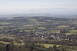
Wyche ( WITCH), often referred to locally as The Wyche, is a village and a suburb of the town of Malvern, Worcestershire, England, and part of the civil parish of Malvern Wells. It is situated approximately 1 mile (1.6 km) south of Great Malvern, the town's centre, on the B4218 road that runs from Malvern to Colwall. The western boundary of the village is marked by The Wyche Cutting, a pass through the Malvern Hills that was once part of an Iron Age salt route, hence the name "Wyche" — several places in England associated with salt have this (or similar) in their name. As the crest of the Malvern Hills (running north to south) defines this part of the border between the two counties of Herefordshire and Worcestershire, The Wyche Cutting itself forms a narrow pass through the hills between the counties. From the 1920s until the 1960s, this road (passing through The Wyche Cutting and Colwall) was the A4105, before being re-classified as the B4218. The Wyche village comprises the two informal areas of Upper Wyche and Lower Wyche, mainly comprising residential properties. The Wyche Inn is a public house situated in Upper Wyche and is the county's highest pub, with views to the east overlooking the Severn valley. Old Wyche Road is one of the country's steepest streets, with an incline as great as 17.54° at Upper Wyche.Just on the Herefordshire side of the Cutting (in Upper Colwall) is the location of the Wyche Innovation Centre, that was the former Skot Transformers building. This is also the home of the Malvern Hills Geocentre, a visitor centre based entirely on iPads with an attached cafe. Also in Upper Colwall is the Wyche Free Church.The nearest railway stations are Great Malvern (for the lower end) and Colwall (for the upper end); both are on the same line. The Wyche CE Primary School is located in Lower Wyche.