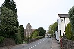
North Hill, Malvern
EngvarB from June 2019Hills of WorcestershireMalvern, WorcestershireMalvern HillsMarilyns of England

North Hill is the second highest point of the range of Malvern Hills that runs about 13 kilometres (8.1 mi) north-south along the Herefordshire-Worcestershire border, although North Hill lies entirely within Worcestershire. It has an elevation of 397 metres (1,302 ft), making it the highest point of the Worcestershire Way. The eastern flank of the hill lies directly behind Worcester road in Great Malvern from where its summit is a brisk 15 – 20 minutes steep walk from the town centre via St Ann's road and Happy Valley. A path from the car park in North Malvern follows the lower contour of North Hill to Happy Valley and St. Ann's Well.
Excerpt from the Wikipedia article North Hill, Malvern (License: CC BY-SA 3.0, Authors, Images).North Hill, Malvern
Lady Howard De Walden Drive, Malvern Hills North Malvern
Geographical coordinates (GPS) Address Nearby Places Show on map
Geographical coordinates (GPS)
| Latitude | Longitude |
|---|---|
| N 52.11454 ° | E -2.33914 ° |
Address
Lady Howard De Walden Drive
Lady Howard De Walden Drive
WR14 4RF Malvern Hills, North Malvern
England, United Kingdom
Open on Google Maps


