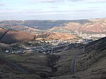
Pant railway station (Brecon and Merthyr Tydfil Junction Railway)
Disused railway stations in Merthyr Tydfil County BoroughFormer Brecon and Merthyr Tydfil Junction Railway stationsFormer Great Western Railway stationsPages with no open date in Infobox stationRailway stations in Great Britain closed in 1962 ... and 2 more
Railway stations in Great Britain opened in 1863Use British English from December 2016
Pant railway station (a.k.a. Pant Junction) was a station which served Pant, Merthyr Tydfil, in the historic Welsh county of Glamorgan, now Merthyr Tydfil County Borough. It was the junction at which the Brecon and Merthyr Tydfil Railway line from Pontsticill in the North split to serve the Dowlais Central and Dowlais Top lines. The line opened in 1859 and closed in 1964. The station had 3 platforms serving the Up and Down services to Dowlais Top, and at a lower level a single platform to Dowlais Central. All 3 lines were single track beyond the station. A new station (opened 1980) is the southern terminus of the Brecon Mountain Railway on an adjacent site.
Excerpt from the Wikipedia article Pant railway station (Brecon and Merthyr Tydfil Junction Railway) (License: CC BY-SA 3.0, Authors).Pant railway station (Brecon and Merthyr Tydfil Junction Railway)
Tai Yr Efail,
Geographical coordinates (GPS) Address External links Nearby Places Show on map
Geographical coordinates (GPS)
| Latitude | Longitude |
|---|---|
| N 51.7782 ° | E -3.3637 ° |
Address
Pant
Tai Yr Efail
CF48 2DW , Pant
Wales, United Kingdom
Open on Google Maps


