Brunton Bank Quarry
Quarries in EnglandSites of Special Scientific Interest in NorthumberlandSites of Special Scientific Interest notified in 1969Wall, Northumberland
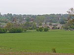
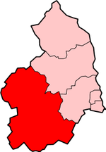
Brunton Bank Quarry is a disused quarry now designated as a Site of Special Scientific Interest (SSSI) in Northumberland, North East England. The quarry exposes a base layer of the Namurian Great Limestone stratigraphic unit, including the Chaetetes Band, the fossilised fauna within which is of current geological interest.
Excerpt from the Wikipedia article Brunton Bank Quarry (License: CC BY-SA 3.0, Authors).Brunton Bank Quarry
Brunton Bank,
Geographical coordinates (GPS) Address Nearby Places Show on map
Geographical coordinates (GPS)
| Latitude | Longitude |
|---|---|
| N 55.023714 ° | E -2.112861 ° |
Address
Brunton Bank (Military Road)
Brunton Bank
NE46 4EQ
England, United Kingdom
Open on Google Maps


