Milecastle 26
Milecastles of Hadrian's WallWall, Northumberland

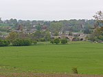
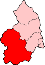
Milecastle 26 (Planetrees) was a milecastle of the Roman Hadrian's Wall. Its position is slightly to the south of, but mostly covered by the B6318 Military Road., and it is located around 700 metres (0.43 mi) east of the B6318 Military Road's junction with the A6079. No visible traces exist currently. The dimensions are the same as Milecastles 23, 24, and 25.
Excerpt from the Wikipedia article Milecastle 26 (License: CC BY-SA 3.0, Authors, Images).Milecastle 26
Brunton Bank,
Geographical coordinates (GPS) Address Nearby Places Show on map
Geographical coordinates (GPS)
| Latitude | Longitude |
|---|---|
| N 55.020461 ° | E -2.10967 ° |
Address
Brunton Bank (Military Road)
Brunton Bank
NE46 4EQ
England, United Kingdom
Open on Google Maps


