Planetrees (Hadrian's Wall section)
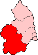
Hadrian's WallWall, Northumberland

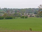
Planetrees is an extant section of Hadrian's Wall named after the farm located around 250 metres (270 yd) to the west. The surviving section is 35 metres (115 ft) in length.
Excerpt from the Wikipedia article Planetrees (Hadrian's Wall section) (License: CC BY-SA 3.0, Authors, Images).Planetrees (Hadrian's Wall section)
Brunton Bank,
Geographical coordinates (GPS) Address Nearby Places Show on map
Geographical coordinates (GPS)
| Latitude | Longitude |
|---|---|
| N 55.021042 ° | E -2.112456 ° |
Address
Brunton Bank (Military Road)
Brunton Bank
NE46 4EQ
England, United Kingdom
Open on Google Maps


