Braintree District
Braintree DistrictNon-metropolitan districts of EssexPages with non-numeric formatnum argumentsUse British English from March 2013

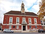
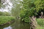
Braintree District is a local government district in Essex, England. The district is named after its largest town, Braintree, where the council is based. The district also includes the towns of Halstead and Witham and surrounding rural areas. The neighbouring districts are Colchester, Maldon, Chelmsford, Uttlesford, South Cambridgeshire, West Suffolk, and Babergh.
Excerpt from the Wikipedia article Braintree District (License: CC BY-SA 3.0, Authors, Images).Braintree District
Bocking End, Essex
Geographical coordinates (GPS) Address Nearby Places Show on map
Geographical coordinates (GPS)
| Latitude | Longitude |
|---|---|
| N 51.8819 ° | E 0.5525 ° |
Address
Bocking End
CM7 9AN Essex
England, United Kingdom
Open on Google Maps


