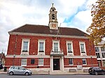
Bocking, Essex

Bocking is a suburban village and former civil parish on the northern side of Braintree, in Essex, England. Bocking village was historically in two parts; the original settlement around the parish church became known as Bocking Churchstreet, while a separate linear settlement called Bocking grew up a little way to the south along Bradford Street and The Causeway, adjoining the northern edge of Braintree. The parish of Bocking was abolished in 1934, merging with Braintree to become the urban district of Braintree and Bocking, which was in turn abolished in 1974 to become part of Braintree District. Both parts of Bocking now form part of the Braintree built up area.Bocking forms an electoral division for Essex County Council elections, and gives its name to Bocking Blackwater, Bocking North and Bocking South wards of Braintree District Council.
Excerpt from the Wikipedia article Bocking, Essex (License: CC BY-SA 3.0, Authors, Images).Bocking, Essex
Rosemary Avenue, Essex
Geographical coordinates (GPS) Address Nearby Places Show on map
Geographical coordinates (GPS)
| Latitude | Longitude |
|---|---|
| N 51.8833 ° | E 0.55 ° |
Address
Rosemary Avenue
Rosemary Avenue
CM7 2SZ Essex
England, United Kingdom
Open on Google Maps


