place

Høybråten Church

1932 establishments in Norway20th-century Church of Norway church buildingsAC with 0 elementsCemeteries in OsloChurches completed in 1932
Lutheran churches in Oslo
Høybråten kirke 2
Høybråten kirke 2

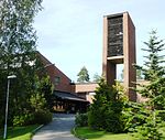
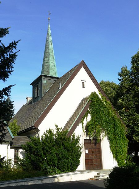
Høybråten Church (Norwegian: Høybråten kirke) is a church dating from 1932 in Oslo, Norway. It was originally a burial chapel at a cemetery which was consecrated in 1929. However, the church was later rebuilt in 1932, and in 1966 it attained the status of a parish church. One of the largest cemeteries in Oslo still surrounds the church. The bell tower is located in the middle of the ridge turret. The church bells are produced by Olsen Nauen bell foundry in Tønsberg. The altarpiece is a mosaic that was created in 1955 by Per Vigeland. The church organ at the organ loft is made by Jørgensens Orgelfabrikk (1974). By the church is a memorial of local casualties during World War II, created by Dagfinn Hermansen and unveiled in 1947. Høybråten Parish House was built near the church, and was finished before Christmas 2002.Høybråten Church is a heritage site and is registered in the Cultural Heritage monument data base of Norway.

Excerpt from the Wikipedia article Høybråten Church (License: CC BY-SA 3.0, Authors, Images).

Høybråten Church
Høybråtenveien, Oslo Stovner

Geographical coordinates (GPS) Address External links Nearby Places
placeShow on map

Wikipedia: Høybråten ChurchContinue reading on Wikipedia

Geographical coordinates (GPS)

Latitude Longitude
N 59.944313055556 ° E 10.909294444444 °
placeShow on map

Address

Høybråten kirke

Høybråtenveien
1055 Oslo, Stovner
Norway
mapOpen on Google Maps

linkWikiData (Q10297243)
linkOpenStreetMap (5010839)

Høybråten kirke 2
Høybråten kirke 2
Share experience

Nearby Places

Grorud Valley
Grorud Valley

The Grorud Valley (Norwegian: Groruddalen) is a valley and urban area or suburb in the northeastern part of Oslo, the capital of Norway. Four of Oslo's boroughs lie within the Grorud Valley; Bjerke to the west, Alna to the south, Grorud to the north, and Stovner to the east. The name Groruddalen has been in use at least since the mid-19th century. The current use of the name Groruddalen was coined in 1960 to describe the area covered by the local newspaper Akers Avis Groruddalen, until then named Akers avis. Before 1960, this area was known as Akersdalen, whilst the name Groruddalen was user for the river valley from lake Alnsjøen along Alna River to Bryn.The population of the Grorud Valley is around 140,000 (approximately a fifth of the population of Oslo). The main population centers are on the valley sides, close to the forest of Lillomarka and Østmarka. The valley basin has fewer houses but a fair amount of industry. Thanks to large scale urbanization throughout the valley in the 1960s and 1970s, it was transformed from agricultural to suburbian landscape. Generally the neighborhoods are well maintained and there are recreational facilities and open spaces in the Grorud Valley.The Grorud Valley is served by several motorways and rail lines running along the valley. In the south of the valley is the European route E6 highway and the subway line Furusetbanen. The central valley is served by Norwegian Route 163 (Østre Aker vei) as well as Hovedbanen rail line. The north side is served by Norwegian Route 4 (Trondheimsveien) and the subway line Grorudbanen.