place

Glynrhonwy quarries

Harv and Sfn no-target errorsLlanberisMining stubsSlate mines in GwyneddUse British English from December 2020
Wales geography stubs
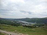
The west wall of the upper pit of Lower Glynrhonwy Quarry geograph.org.uk 336554

The Glynrhonwy quarries (also known as the Glyn-Rhonwy quarries) were two adjacent quarries in the Glynrhonwy area, north-west of Llanberis, in Carnarvonshire (now Gwynedd), Wales. They were: Upper Glynrhonwy quarry, known locally as "Glyn Ganol" or "Middle Glyn", which operated from 1861 to 1930, and Lower Glynrhonwy quarry, known locally as "Captain Taylor's Quarry", which operated from the early 1700s to 25 January 1930.The quarries operated internal railways of 2 ft (610 mm) gauge and were served by Glynrhonwy Siding off the LNWR's Caernarfon to Llanberis branch.Lower Glynrhonwy was acquired by the Air Ministry in 1939 for munitions storage. It occupied the site until 1961. During the Second World War the site generated two extra trains per day on some occasions. The railway siding was taken out of use on 18 December 1956.A 100 MW pumped storage project, marketed as a "quarry battery", received approval in 2017 and as at 2019 had reached the "detailed engineering design" stage.

Excerpt from the Wikipedia article Glynrhonwy quarries (License: CC BY-SA 3.0, Authors, Images).

Glynrhonwy quarries
Ffordd Clegir,

Geographical coordinates (GPS) Address Nearby Places
placeShow on map

Wikipedia: Glynrhonwy quarriesContinue reading on Wikipedia

Geographical coordinates (GPS)

Latitude Longitude
N 53.123611111111 ° E -4.1480555555556 °
placeShow on map

Address

Ffordd Clegir

Ffordd Clegir
LL55 4HS , Llanrug
Wales, United Kingdom
mapOpen on Google Maps

The west wall of the upper pit of Lower Glynrhonwy Quarry geograph.org.uk 336554
Share experience

Nearby Places

Llyn Padarn
Llyn Padarn

Llyn Padarn is a glacially formed lake in Snowdonia, Gwynedd, north Wales, and is an example of a moraine dammed lake. The lake is approximately 2 miles (3.2 km) long (about 240 acres) and at its deepest point is 94 feet (29 m) deep, and is one of the largest natural lakes in Wales. At its south-eastern end it is linked to the neighbouring Llyn Peris (which forms the lower reservoir of the Dinorwig power station). The busy village of Llanberis lies on the southern banks of the lake. Most of Llyn Padarn is owned by Gwynedd Council and is part of Padarn Country Park. Whilst kayaking, rowing and sailing are permitted on the lake, powered craft require permission to use it. Bangor University Rowing Club row at Llyn Padarn. In April 2014 Llyn Padarn was designated as Bathing Water under the Bathing Water Directive (2006/7/EC). The outflow of Llyn Padarn is on the northern shore and is called Afon Rhythallt, which passes by the village of Brynrefail, Gwynedd and becomes Afon Seiont below Pont Rhythallt, near Llanrug. It reaches the sea at Caernarfon. Padarn Country Park is located on the northern flank of the lake, including Coed Allt Wen, a rare and ancient sessile oak woodland. Both the woodland and Llyn Padarn are designated as Sites of Special Scientific Interest. The Llanberis Lake Railway also runs along its eastern bank and various recreational activities take place on the lake, especially during the summer. These include canoeing, boating and fishing. The lake was the venue for the rowing events of the 1958 British Empire and Commonwealth Games. Former local bus company Padarn Bus, which operated between 1979 and 2014 from a base at nearby Llanberis, was named after the lake.Llyn Padarn is named after Padarn, an early 6th century saint, who has a church dedicated to him in Llanberis.

Padarn Halt railway station

Padarn Halt was a passenger only railway station located in Llanberis, Gwynedd, Wales, on the western shore of Llyn Padarn. It opened on 21 November 1936 and closed on the outbreak of the Second World War. The line through the station remained in use for excursions until 1962 and for freight until 1964; it was lifted in 1965. The LMSR closed the Llanberis branch to regular passenger services in 1930, though frequent Summer excursions continued to run. In 1934 the company reinstated a regular Saturdays only train specifically to serve Caernarfon market. In many parts of Britain "Market Trains" were an established part of local commerce and social life in a way which has passed into history. Llanberis station was not in the centre of Llanberis, so the company built the halt half a mile from the terminus specifically for this market traffic. The halt opened on 21 November 1936, from which time the market trains used the halt there instead of at Llanberis station. The halt consisted of an unlit single wooden platform on trestles, with a very small wooden waiting shelter at its southern end. It was accessed by a gravel footpath which continued over the tracks to the lakeside by a foot crossing. The 1939 working timetable shows that some excursions made unadvertised stops at the halt.The track bed from Llanberis through the site of the halt (at what is now the lakeside entrance to the industrial estate) as far as Cwm-y-Glo is now occupied by the improved A4086, which by-passes the centre of Llanberis. No trace of the station remains.