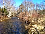
Fishers Brook (Connecticut)
Connecticut geography stubsLandforms of Tolland County, ConnecticutMansfield, ConnecticutRivers of ConnecticutTributaries of the Thames River (Connecticut)
Fishers Brook is a stream that runs for about 4,000 meters (13,123 feet) at its maximum length in spring. Most of the year, it reaches only 3,000 meters (9842.52 feet). It is located in Storrs, Connecticut. It feeds several small wetlands, including one small pond, before dropping off into Codfish Falls. It then leads into the Fenton River. Just before the falls, as well as in several other places, it is intersected by small bridges.
Excerpt from the Wikipedia article Fishers Brook (Connecticut) (License: CC BY-SA 3.0, Authors).Fishers Brook (Connecticut)
Codfish Falls Road,
Geographical coordinates (GPS) Address Nearby Places Show on map
Geographical coordinates (GPS)
| Latitude | Longitude |
|---|---|
| N 41.823972222222 ° | E -72.226861111111 ° |
Address
Codfish Falls Road 164
06268
Connecticut, United States
Open on Google Maps


