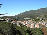
Col du Perthus
Mountain passes of CataloniaMountain passes of Occitania (administrative region)Mountain passes of the PyreneesOccitania (administrative region) geography stubsProvince of Girona geography stubs

The Col du Perthus (in Catalan: Coll de Pertús) is a mountain pass of the Pyrenees on the France–Spain border, between the Pyrénées-Orientales in Languedoc-Roussillon, Midi-Pyrénées and the Province of Girona in Catalonia. Rising to an altitude of 290 metres (950 ft), it is one of the lowest border passes in the Pyrenees. It marks the western boundary of the Albera Massif. The village of Le Perthus was founded at the col in 1836. The location is the subject of a noted engraving by Gustave Doré, reproduced in Doré’s Spain.
Excerpt from the Wikipedia article Col du Perthus (License: CC BY-SA 3.0, Authors, Images).Col du Perthus
Autopista de la Mediterrània,
Geographical coordinates (GPS) Address Nearby Places Show on map
Geographical coordinates (GPS)
| Latitude | Longitude |
|---|---|
| N 42.463888888889 ° | E 2.8655555555556 ° |
Address
Autopista de la Mediterrània
Autopista de la Mediterrània
17700
Catalonia, Spain
Open on Google Maps


