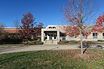
Manchester–Boston Regional Airport

Manchester–Boston Regional Airport (IATA: MHT, ICAO: KMHT, FAA LID: MHT), commonly referred to as Manchester Airport, is a public use airport 3 miles (5 km) south of the central business district of Manchester, New Hampshire, United States on the border of Hillsborough and Rockingham counties. It is owned by the City of Manchester, and is in the southern part of the city on the border with Londonderry, New Hampshire. Opened in 1927, Manchester–Boston Regional Airport is by far the busiest airport in New Hampshire, with ten times the traffic of the next-busiest, Portsmouth. It is the only airport in the state with substantial commercial service. It is also New England's fifth-largest airport by passenger volume, behind Boston Logan in Massachusetts; Bradley International in Connecticut; T. F. Green in Rhode Island; and Portland International Jetport in Maine. It moved more than 1 million passengers in a year for the first time in 1997. After years of growth, it handled 4.33 million passengers in 2005, its peak year. Passenger tallies have declined since then, similarly with many regional airports; it handled 1.85 million passengers in 2018, and traffic fell sharply during the COVID-19 pandemic. It is included in the Federal Aviation Administration (FAA) National Plan of Integrated Airport Systems for 2021–2025, in which it is categorized as a small hub primary commercial service facility. The facility was known as Manchester Airport until April 18, 2006, when it added "Boston Regional" to advertise its proximity to Boston, about 50 miles (80 km) to the south. Certified for Cat III B Instrument Landing operations, the airport has a reputation for never surrendering to bad weather. The airport has closed only once, when the national airspace was shut down for two days following the September 11 terrorist attacks, after which all American airports were required to close. It is home to the Aviation Museum of New Hampshire, built around an Art Deco control tower, and its terminal opened in 1938.
Excerpt from the Wikipedia article Manchester–Boston Regional Airport (License: CC BY-SA 3.0, Authors, Images).Manchester–Boston Regional Airport
Akira Way,
Geographical coordinates (GPS) Address Website External links Nearby Places Show on map
Geographical coordinates (GPS)
| Latitude | Longitude |
|---|---|
| N 42.9325 ° | E -71.435555555556 ° |
Address
Manchester–Boston Regional Airport
Akira Way
03109
New Hampshire, United States
Open on Google Maps


