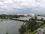
Tanjong Rhu

Tanjong Rhu (Chinese: 丹戎禺, Tamil: தஞ்சோங் ரூ) is a subzone within the planning area of Kallang, Singapore, as defined by the Urban Redevelopment Authority (URA). The perimeter of Tanjong Rhu is made up of Nicoll Highway in the north; Mountbatten Road and Fort Road in the east; East Coast Parkway (ECP) in the south; as well as Marina Channel and Kallang Basin in the west. Tanjong Rhu is the largest in terms of physical area among the nine subzones that make up Kallang. Consisting of residential, commercial and recreational developments, Tanjong Rhu is famous for being the location of the Singapore Sports Hub, which includes the Kallang Wave Mall, new National Stadium and the Singapore Indoor Stadium. Previously, the old National Stadium which hosted a total of 18 National Day Parades sat on the land now occupied by the new National Stadium. The former Kallang Airport once extended into this area, with part of its old runway being the modern-day Stadium Boulevard. Other sports facilities in Tanjong Rhu include the Kallang Tennis Centre, Kallang Field, Kallang Ground, Kallang Track, Kallang Netball Centre, Kallang Squash Centre and PAssion WaVe @ Marina Bay. Notable places include Kallang Theatre, Leisure Park Kallang, Mountbatten Fire Post, Katong Community Centre, Singapore Swimming Club, the Benjamin Sheares Bridge and Dunman High School, one of Singapore's leading educational institutions. Tanjong Rhu is currently served by two Mass Rapid Transit (MRT) stations on the Circle line: Stadium MRT station and Mountbatten MRT station. In 2023, two more stations along the Thomson–East Coast line will open: Tanjong Rhu MRT station and Katong Park MRT station. Tanjong Rhu is an affluent residential neighbourhood, made up of mostly condominiums and private housing along Tanjong Rhu Road. A few blocks of public housing built by the Housing and Development Board (HDB) exist along Kampong Arang Road and Kampong Kayu Road. These residential estates are connected to the Singapore Sports Hub via Stadium Way, across the Geylang River.
Excerpt from the Wikipedia article Tanjong Rhu (License: CC BY-SA 3.0, Authors, Images).Tanjong Rhu
Marina Promenade, Singapore Kallang
Geographical coordinates (GPS) Address Nearby Places Show on map
Geographical coordinates (GPS)
| Latitude | Longitude |
|---|---|
| N 1.3011 ° | E 103.8685 ° |
Address
Marina Promenade
Marina Promenade
119587 Singapore, Kallang
Singapore
Open on Google Maps


