place

Merdeka Bridge, Singapore

Bridges completed in 1956Bridges in SingaporeKallang
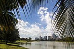
Merdeka Bridge, Dec 05

The Merdeka Bridge (Chinese: 独立桥, Malay: Jambatan Merdeka) is a vehicular and pedestrian bridge located in Kallang in the south-eastern part of Singapore. It spans the river mouths of the Kallang River and Rochor River, which empty into the Kallang Basin. Designed by R. J. Hollis-Bee of the then Public Works Department (now CPG Corporation), the bridge was officially opened on 17 August 1956. The Merdeka Bridge carries Nicoll Highway, a semi-expressway connecting Kallang with the Singapore downtown.

Excerpt from the Wikipedia article Merdeka Bridge, Singapore (License: CC BY-SA 3.0, Authors, Images).

Merdeka Bridge, Singapore
Stadium Road,

Geographical coordinates (GPS) Address External links Nearby Places
placeShow on map

Wikipedia: Merdeka Bridge, SingaporeContinue reading on Wikipedia

Geographical coordinates (GPS)

Latitude Longitude
N 1.3042361111111 ° E 103.86839166667 °
placeShow on map

Address

Merdeka Bridge

Stadium Road
119587 , Kallang
Singapore
mapOpen on Google Maps

linkWikiData (Q14874290)
linkOpenStreetMap (620298236)

Merdeka Bridge, Dec 05
Share experience

Nearby Places

Nicoll Highway collapse

The Nicoll Highway collapse occurred in Singapore on 20 April 2004 at 3:30 pm local time when a Mass Rapid Transit (MRT) tunnel construction site caved in, leading to the collapse of the Nicoll Highway near the Merdeka Bridge. Four workers were killed and three were injured, delaying the construction of the Circle Line (CCL). The collapse was caused by a poorly designed strut-waler support system, a lack of monitoring and proper management of data caused by human error, organisational failures of the Land Transport Authority (LTA) and construction contractors Nishimatsu and Lum Chang. The Singapore Civil Defence Force extracted three bodies from the site but were unable to retrieve the last due to unstable soil. An inquiry was conducted by Singapore's Manpower Ministry from August 2004 to May 2005, after which three Nishimatsu engineers and an LTA officer were charged under the Factories Act and Building Control Act respectively, and all four defendants were fined. The contractors gave S$30,000 (US$20,000) each to the families of the victims as unconditional compensation. Following the incident, the collapsed site was refilled, and Nicoll Highway was rebuilt and reopened to traffic on 4 December 2004. Heng Yeow Pheow, an LTA foreman whose body was never recovered, was posthumously awarded the Pingat Keberanian (Medal of Valour) for helping his colleagues to safety ahead of himself. In response to inquiry reports, the LTA and the Building and Construction Authority (BCA) revised their construction safety measures so they were above industry standards. The CCL tunnels were realigned, with Nicoll Highway station rebuilt to the south of the original site underneath Republic Avenue. The station and tunnels opened on 17 April 2010, three years later than planned.

Tanjong Rhu
Tanjong Rhu

Tanjong Rhu (Chinese: 丹戎禺, Tamil: தஞ்சோங் ரூ) is a subzone within the planning area of Kallang, Singapore, as defined by the Urban Redevelopment Authority (URA). The perimeter of Tanjong Rhu is made up of Nicoll Highway in the north; Mountbatten Road and Fort Road in the east; East Coast Parkway (ECP) in the south; as well as Marina Channel and Kallang Basin in the west. Tanjong Rhu is the largest in terms of physical area among the nine subzones that make up Kallang. Consisting of residential, commercial and recreational developments, Tanjong Rhu is famous for being the location of the Singapore Sports Hub, which includes the Kallang Wave Mall, new National Stadium and the Singapore Indoor Stadium. Previously, the old National Stadium which hosted a total of 18 National Day Parades sat on the land now occupied by the new National Stadium. The former Kallang Airport once extended into this area, with part of its old runway being the modern-day Stadium Boulevard. Other sports facilities in Tanjong Rhu include the Kallang Tennis Centre, Kallang Field, Kallang Ground, Kallang Track, Kallang Netball Centre, Kallang Squash Centre and PAssion WaVe @ Marina Bay. Notable places include Kallang Theatre, Leisure Park Kallang, Mountbatten Fire Post, Katong Community Centre, Singapore Swimming Club, the Benjamin Sheares Bridge and Dunman High School, one of Singapore's leading educational institutions. Tanjong Rhu is currently served by two Mass Rapid Transit (MRT) stations on the Circle line: Stadium MRT station and Mountbatten MRT station. In 2023, two more stations along the Thomson–East Coast line will open: Tanjong Rhu MRT station and Katong Park MRT station. Tanjong Rhu is an affluent residential neighbourhood, made up of mostly condominiums and private housing along Tanjong Rhu Road. A few blocks of public housing built by the Housing and Development Board (HDB) exist along Kampong Arang Road and Kampong Kayu Road. These residential estates are connected to the Singapore Sports Hub via Stadium Way, across the Geylang River.

Rochor River
Rochor River

Rochor River (Simplified Chinese: 梧槽河, Malay: Sungei Rochor) is a canalised river in Kallang of the Central Region in Singapore. The river is about 0.8 km in length. Rochor River is a continuation of the Rochor Canal, and begins beneath Victoria Bridge and empties into the Kallang Basin. The Rochor Canal continues upstream as far as the junction of Jalan Jurong Kechil and Upper Bukit Timah Road; the source of the Rochor River lies in Beauty World MRT station, which has a possible extension to Tengah as part of the Deep Tunnel Sewerage System, it also has a canal that leads to the Kranji Reservoir. "Rochor Canal" is also the name of a subzone within the planning area of Rochor.The river has often been regulated in the past and expanded by channels to control the floods in Bukit Timah. While the lower course is undoubtedly called the Rochor River, the Victoria Bridge upstream alternatively uses the name Rochor Canal or - even more upstream - Bukit Timah Canal, as can be found on various maps. The canal has been cleaned and renovated frequently. Because this did not help, the Bukit Timah Flood Alleviation Scheme (BTFAS) of the Singapore National Water Agency PUB (built in the 1960s) added two additional service channels: the Bukit Timah First Diversion Canal (1966-1972, 3.2 km after Pandan Reservoir) and the Bukit Timah Second Diversion Canal (1990s, 4.4 km long, to Kallang Basin). They partly run underground in tunnels. The originated in the 1830s Rochor Canal favored the emergence of cattle trading in Little India. With its water, the pastures were fed, where the buffalo grazed and where the trade was done with them. Today's wet market Tekka Center (also known as Tekka Market) used to be called Kandang Kerbau Market ("KK Market") in 1915, where "kerbau" in Malay means something like "cattle enclosure". In addition to cattle breeding developed in this area, known as Kampong Kerbau ("Buffalo Village", about cattle village in Malay), farms such as slaughterhouses, dairy and similar. In the 1880s oxen and cowsheds as well as pony and horse stables were to be found throughout the district. The cattle breeding reached its peak around 1900. The river (and canal) used to be an important waterway for the timber industry, with many sawmills and wood factories on its banks. Throughout, tree trunks from Indonesia and Malaysia were transported to them. In 2011, the Water Authority PUB - Singapore's National Water Agency decided to build a 1.1 km section of the Rochor Canal, which was particularly degenerate. This redevelopment was part of the program "Active, Beautiful, Clean Waters Program" (ABC Water program); the cost was estimated at S $48 million. There should be an attractive stretch of river with urban boulevard, promenades, pedestrian bridges, terraces, several gardens and a community space. The new section, which replaced the old unhygienic canal management, was officially opened on 8 March 2015.

Geylang River
Geylang River

Geylang River (Malay: Sungai Geylang; Simplified Chinese: 芽茏河) is a canalised river flowing from Geylang to Kallang, in the Central Region of Singapore. With the formation of the Marina Reservoir after the completion of the Marina Barrage in 2008, the river now forms part of the reservoir. Geylang River begins at Ubi as Geylang Canal, continues southwards under Eunos Road 5 and Sims Avenue, and turns westwards after Geylang Road and Lorong 40 Geylang, but flows southwards again near Guillemard Road, before turning westwards again after the junction of Old Airport Road and Dunman Road, through Mountbatten Road and Stadium Way. The river finally empties into the Kallang Basin near Tanjong Rhu in the southern part of Kallang near the Tanjong Rhu Suspension Bridge. The Geylang Park Connector of the Park Connector Network (PCN) runs almost parallel to the Geylang River, providing a stretch of recreational space along the river between Guillemard Road and Tanjong Rhu. The Paya Lebar Quarter straddles both sides of the Geylang River. Geylang River has gone through a two years long revamp initiated by the Public Utilities Board (PUB) programme, which revitalised the waterway while preserving the rich heritage of the areas around Geylang River, and was opened by Guest-of-Honour Associate Professor Fatimah Lateef, Member of Parliament for Marine Parade Group Representation Constituency. As part of the revamp, Geylang River was also deepened and widened to increase its capacity and enhance flood protection. As part of an Active, Beautiful and Clean (ABC) Waters project by Paya Lebar Quarter, a natural rain garden which treats surface runoff using plants and soil was also set up to improve the quality of the river's water.