Guará, Federal District
Administrative regions in the Federal District (Brazil)Federal District (Brazil) geography stubs
_DF_Brasil_-_Vista_a_partir_de_Ainiqueiras_-_panoramio.jpg)
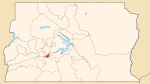
Guará (Portuguese pronunciation: [ɡuaˈɾa]) is an administrative region in the Federal District in Brazil. It is bordered by SIA to the north, Sudoeste/Octogonal and Candangolândia to the west, Núcleo Bandeirante to the south, Park Way to the southeast, and Águas Claras to the east, and Vicente Pires to the northeast. It was founded on 5 May 1969, as the 10th administrative region.
Excerpt from the Wikipedia article Guará, Federal District (License: CC BY-SA 3.0, Authors, Images).Guará, Federal District
Avenida Contorno, Guará
Geographical coordinates (GPS) Address Nearby Places Show on map
 Continue reading on Wikipedia
 Geographical coordinates (GPS)
| Latitude | Longitude |
|---|---|
| N -15.825555555556 ° | E -47.98 ° |
Address
Avenida Contorno
Avenida Contorno
71050-610 Guará
Federal District, Brazil
Open on Google Maps