Candangolândia
1994 establishments in BrazilAdministrative regions in the Federal District (Brazil)Federal District (Brazil) geography stubsPopulated places established in 1994

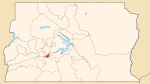
Candangolândia (Portuguese pronunciation: [kɐn.dɐn.ɡoˈlɐ̃n.dʒiɐ]) is an administrative region in the Federal District in Brazil. It is bordered by Brasília to the north, Lago Sul to the east, Park Way and Núcleo Bandeirante to the south, and Guará to the west. Its population is 16,196 according to a 2010 report. Candangolândia was first formed on 3 November 1956, but was officially recognized as the 19th administrative region in 1994 via law n°658.
Excerpt from the Wikipedia article Candangolândia (License: CC BY-SA 3.0, Authors, Images).Candangolândia
Rua dos Transportes, Região Geográfica Imediata do Distrito Federal
Geographical coordinates (GPS) Address Nearby Places Show on map
 Continue reading on Wikipedia
 Geographical coordinates (GPS)
| Latitude | Longitude |
|---|---|
| N -15.854444444444 ° | E -47.95 ° |
Address
Rua dos Transportes
Rua dos Transportes
70610-100 Região Geográfica Imediata do Distrito Federal
Federal District, Brazil
Open on Google Maps