Blendworth

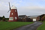
Blendworth is a village and former civil parish, now in the parish of Horndean, in the East Hampshire district of Hampshire, England. It lies 0.4 miles (0.6 km) northeast of Horndean just east off the A3 road. The village has a population of fewer than 100 people, in 1931 the parish had a population of 398. On 1 April 1932 the parish was abolished and merged with Horndean, Rowlands Castle and Havant. The church, Holy Trinity, was erected in 1850–51, and until recently had a C of E Infant School next to it. Blendworth also has a brass band. and had stables until 2022 when all the land belonging to Myrtle Farm - which included the stables - was sold. The nearest railway station is 2.2 miles (3.5 km) southeast of the village, at Rowlands Castle. The village is also close to Chalton, Finchdean and Rowlands Castle.
Excerpt from the Wikipedia article Blendworth (License: CC BY-SA 3.0, Authors, Images).Blendworth
Crabden Lane, East Hampshire Horndean
Geographical coordinates (GPS) Address Nearby Places Show on map
Geographical coordinates (GPS)
| Latitude | Longitude |
|---|---|
| N 50.91694 ° | E -0.98929 ° |
Address
Crabden Lane
Crabden Lane
PO8 0QG East Hampshire, Horndean
England, United Kingdom
Open on Google Maps


