place

Storevar

SandefjordVestfold og Telemark geography stubsVillages in Vestfold og Telemark

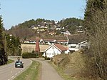
Storevar is a village in Sandefjord Municipality in Vestfold county, Norway. The village is located along the Tønsbergfjorden, just south of the village of Melsomvik, about 4 kilometres (2.5 mi) to the southeast of the large village of Stokke, and about 5 kilometres (3.1 mi) to the north of the village of Råstad. The 0.2-square-kilometre (49-acre) village had a population (2014) of 339 and a population density of 1,695 inhabitants per square kilometre (4,390/sq mi). Since 2015, the population and area data for this village area has not been separately tracked by Statistics Norway, but instead it has been considered part of the Melsomvik urban area.There are three islands in the fjord just outside Storevar: Gåsøykalven, Gåsøy, and Ravnø. During winters, the ocean occasionally freezes and makes it possible to hike to the islands from the village.

Excerpt from the Wikipedia article Storevar (License: CC BY-SA 3.0, Authors).

Storevar
Storevarveien, Sandefjord

Geographical coordinates (GPS) Address Nearby Places
placeShow on map

Wikipedia: StorevarContinue reading on Wikipedia

Geographical coordinates (GPS)

Latitude Longitude
N 59.20282 ° E 10.32489 °
placeShow on map

Address

Storevarveien 310
3160 Sandefjord
Norway
mapOpen on Google Maps

Share experience

Nearby Places

Sundås battery
Sundås battery

Sundås battery (Norwegian: Sundås batteri) is a defunct coastal artillery site located at Sundåsen in Sandefjord Municipality (historically part of Stokke Municipality) in Vestfold county, Norway. The fortifications were constructed in 1899 during turbulent times with Sweden during the Union between Sweden and Norway. It was part of the newly established Norwegian Coastal Artillery (Kystartilleriet). The fort was erected to keep potential enemies from entering the Tønsberg area by sea, and was also meant to protect the Marine harbor in the village of Melsomvik. Work on the fort began in 1897, and the forts at both Håøya Island and Sundåsen were completed in 1899. Trenches, commando posts, fencing, concrete gun pits, and other remains from the fort can still be seen at Sundås. The fort lies by the Tønsbergfjorden with surrounding views of Færder Lighthouse and islands such as Håøya, Tjøme, Veierland, and Nøtterøy. The cannons were dismantled by German occupational forces in 1942 during the German occupation of Norway and moved to other fortifications elsewhere in Norway. After the war, the battery reverted to the Norwegian Armed Forces who managed the property until 1962 when an agreement for maintenance and management was made with the municipality in return for public access. In 2005, the area was sold off to Stokke municipality.The fortifications were originally constructed to protect the marine harbor in Melsomvik from a potential Swedish invasion. Views from the fort include the Tønsbergfjord, the Swedish coastline in the east, and the Skrim mountains in the west.