place

Interlaken

Cultural property of national significance in the canton of BernInterlakenModule:Wd reference errorsMunicipalities of the canton of BernPages with German IPA
Populated places on the AareResorts in Switzerland
Europe Pictures 001
Europe Pictures 001

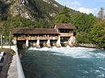
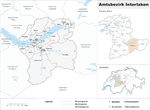
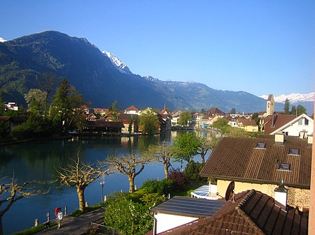
Interlaken (German pronunciation: [ˈɪntərlakŋ̍]; lit.: between lakes) is a Swiss town and municipality in the Interlaken-Oberhasli administrative district in the canton of Bern. It is an important and well-known tourist destination in the Bernese Oberland region of the Swiss Alps, and the main transport gateway to the mountains and lakes of that region. The town is located on flat alluvial land called Bödeli between two lakes, Brienz to the east and Thun to the west, and alongside the river Aare, which flows between them. Transport routes to the east and west alongside the lakes are complemented by a route southwards into the near mountain resorts and high mountains, e.g. the famous high Alpine peaks of Eiger, Mönch, and Jungfrau, following upwards the Lütschine. Interlaken is the central town of a Small Agglomeration with the same name of 23,300 inhabitants.The official language of Interlaken is German, but the main spoken language is the local variant of the Alemannic Swiss German dialect, Bernese German.

Excerpt from the Wikipedia article Interlaken (License: CC BY-SA 3.0, Authors, Images).

Interlaken
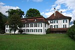
Schloß Waldeck, Waldeck

Geographical coordinates (GPS) Address Phone number Website Nearby Places
placeShow on map

Wikipedia: InterlakenContinue reading on Wikipedia

Geographical coordinates (GPS)

Latitude Longitude
N 46.683333333333 ° E 7.85 °
placeShow on map

Address

Hotel Schloss Waldeck

Schloß Waldeck 1
34513 Waldeck
Hessen, Deutschland
mapOpen on Google Maps

Phone number
Schloss Waldeck Hotelbetriebs GmbH & Co. KG

call+4956235890

Website
hotel-schloss-waldeck.de

linkVisit website

Europe Pictures 001
Europe Pictures 001
Share experience

Nearby Places

Bernese Oberland
Bernese Oberland

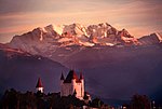
The Bernese Oberland (English: Bernese Highlands, German: Berner Oberland; Alemannic German: Bärner Oberland; French: Oberland bernois), the highest and southernmost part of the canton of Bern, is one of the canton's five administrative regions (in which context it is referred to as Oberland without further specification). It constitutes the Alpine region of the canton and the northern side of the Bernese Alps, including many of its highest peaks, among which the Finsteraarhorn (4,274 m (14,022 ft)), the highest in both range and canton. The region essentially coincides with the upper basin of the Aare, the latter notably including Lake Thun and Lake Brienz, the two large lakes of the region. On the banks of the lakes or the Aare are the main settlements of Thun, Spiez, Interlaken, Brienz and Meiringen. The numerous side valleys of the Bernese Oberland include a large number of Alpine villages, many of them being tourist resorts and connected by mountain railways to Spiez and Interlaken. The Lötschberg, a major north-south axis through the Alps, links the region with both the capital of the canton, Bern, and its sizable southern neighbour, the canton of Valais. The flag of the Bernese Oberland consists of a black eagle in a gold field (in reference to the region's old status as reichsfrei) over two fields in the cantonal colours of red and black. The Swiss German dialects spoken in the Bernese Oberland are Highest Alemannic German, contrasting with the High Alemannic Bernese German spoken in Bern and the northern parts of the canton. In the short-lived Helvetic Republic (1798–1803), the Bernese Oberland was a separate canton.