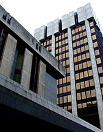
Manchester Piccadilly Gardens bus station

Manchester Piccadilly Gardens bus station, often abbreviated to Piccadilly Gardens, is one of two main bus stations in Manchester city centre. Adjacent is a Manchester Metrolink station named Piccadilly Gardens. The majority of the stands are located between Piccadilly Gardens and the Piccadilly Plaza, where buses for south or west Manchester usually begin or end their route. Other stands, also serving Piccadilly Gardens, are located on Oldham Street, Piccadilly or Lever Street for services heading towards north or east of Manchester. The bus station was first opened on the site of the demolished Manchester Infirmary in 1931 to serve as the new terminus of the various extensive regional express bus services run by Manchester and its partners that had to be curtailed under the Road Traffic Act of 1930 and subsequent regulation of bus services. The station was extended in 1932/33 and finally extended to form the full length of Parker Street in 1935.
Excerpt from the Wikipedia article Manchester Piccadilly Gardens bus station (License: CC BY-SA 3.0, Authors, Images).Manchester Piccadilly Gardens bus station
Piccadilly Gardens, Manchester City Centre
Geographical coordinates (GPS) Address Nearby Places Show on map
Geographical coordinates (GPS)
| Latitude | Longitude |
|---|---|
| N 53.48032 ° | E -2.23751 ° |
Address
Piccadilly Gardens (Stand L)
Piccadilly Gardens
M1 1AF Manchester, City Centre
England, United Kingdom
Open on Google Maps


