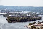
McKees Rocks Bridge
1931 establishments in PennsylvaniaAllegheny County, Pennsylvania Registered Historic Place stubsBridges completed in 1931Bridges in Allegheny County, PennsylvaniaBridges in Pittsburgh ... and 9 more
Bridges over the Ohio RiverHistoric American Engineering Record in PennsylvaniaNational Register of Historic Places in Allegheny County, PennsylvaniaOpen-spandrel deck arch bridges in the United StatesPennsylvania bridge (structure) stubsPittsburgh History & Landmarks Foundation Historic LandmarksRoad bridges on the National Register of Historic Places in PennsylvaniaSteel bridges in the United StatesThrough arch bridges in the United States

The McKees Rocks Bridge is a steel trussed through arch bridge which carries the Blue Belt, Pittsburgh's innermost beltline, across the Ohio River at Brighton Heights and McKees Rocks, Pennsylvania, west of the city. At 7,293 feet (2,223 m) long, it is the longest bridge in Allegheny County.Built in 1931, it was listed on the National Register of Historic Places in 1988.
Excerpt from the Wikipedia article McKees Rocks Bridge (License: CC BY-SA 3.0, Authors, Images).McKees Rocks Bridge
McKees Rocks Bridge, Pittsburgh
Geographical coordinates (GPS) Address External links Nearby Places Show on map
Geographical coordinates (GPS)
| Latitude | Longitude |
|---|---|
| N 40.47704 ° | E -80.0489 ° |
Address
McKees Rocks Bridge
McKees Rocks Bridge
15283 Pittsburgh
Pennsylvania, United States
Open on Google Maps


