St Saviour's Dock
Geography of the London Borough of SouthwarkLondon docksPort of LondonUse British English from December 2017

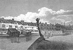
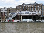
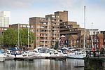
St Saviour's Dock is an inlet-style dock in London, England, on the south bank of the River Thames, 420 metres east of Tower Bridge. It forms the eastern end of the Shad Thames embankment that starts at Tower Bridge. The east side of the Dock is Jacob's Island.
Excerpt from the Wikipedia article St Saviour's Dock (License: CC BY-SA 3.0, Authors, Images).St Saviour's Dock
Mill Street, London Bermondsey (London Borough of Southwark)
Geographical coordinates (GPS) Address Nearby Places Show on map
Geographical coordinates (GPS)
| Latitude | Longitude |
|---|---|
| N 51.5022 ° | E -0.071 ° |
Address
New Concordia Wharf
Mill Street
SE1 2DZ London, Bermondsey (London Borough of Southwark)
England, United Kingdom
Open on Google Maps


