River Neckinger
AC with 0 elementsSubterranean rivers of LondonThames drainage basinUse British English from October 2017

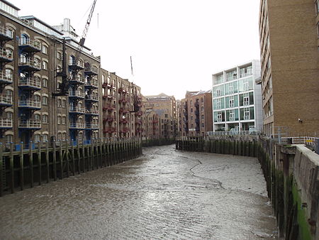
The River Neckinger is a reduced subterranean river that rises in Southwark and flows approximately 2.5 kilometres (1.6 miles) through that part of London to St Saviour's Dock where it enters the Thames. What remains of the river is enclosed and runs underground and most of its narrow catchment has been diverted into other combined and surface water sewers, flowing into the Southern Outfall Sewer and the Thames respectively.
Excerpt from the Wikipedia article River Neckinger (License: CC BY-SA 3.0, Authors, Images).River Neckinger
Jamaica Road, London Bermondsey (London Borough of Southwark)
Geographical coordinates (GPS) Address Nearby Places Show on map
Geographical coordinates (GPS)
| Latitude | Longitude |
|---|---|
| N 51.500555555556 ° | E -0.073333333333333 ° |
Address
Jamaica Road
Jamaica Road
SE1 2YU London, Bermondsey (London Borough of Southwark)
England, United Kingdom
Open on Google Maps


