Breedeweg

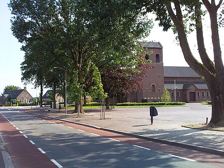
Breedeweg is a village in the Dutch province of Gelderland. It is located in the municipality of Berg en Dal, about 1 km south of Groesbeek.It was first mentioned in 1899 as Breedeweg, and means "wide road". The St. Antonius Church was built in 1934, and destroyed in 1944 during Operation Market Garden. In 1949, the church was rebuilt, and a monument has been erected for the dead allied soldiers and the two civilians who were killed by a grenade while cleaning up the debris.Breedeweg and Groesbeek have been expanding, and are now close to one-another. In the late 2010s, the municipality changed the place name sign to "Groesbeek Breedeweg". Nevertheless, it is still a separate village and not annexed.
Excerpt from the Wikipedia article Breedeweg (License: CC BY-SA 3.0, Authors, Images).Breedeweg
Kerkpad, Berg en Dal
Geographical coordinates (GPS) Address Nearby Places Show on map
Geographical coordinates (GPS)
| Latitude | Longitude |
|---|---|
| N 51.7578 ° | E 5.9402 ° |
Address
Kerkpad 19
6562 GA Berg en Dal
Gelderland, Netherlands
Open on Google Maps


