place

Trump International Hotel and Tower (New Orleans)

Condo hotels in the United StatesHotels in New OrleansProposed skyscrapers in the United StatesUnbuilt buildings and structures in the United States

The Trump International Hotel and Tower was a proposed residential tower located in the Central Business District of New Orleans, Louisiana. It was a project of real estate mogul Donald Trump's Trump Organization. Supposedly in the planning stages from summer 2005 on, the project was finally declared dead in July 2011 after the location land was foreclosed on and sold at auction. If constructed, the Trump Tower would have become the tallest building in the city of New Orleans and the state of Louisiana, at seventy stories. At a height of 716 feet (218 m) along with a 126-foot (38 m) spire, it would also be the tallest building along the Gulf Coast outside of Houston, as well as the tallest point in the state of Louisiana. (Louisiana's highest peak is Driskill Mountain, at 535 feet.) It was planned to be a multi-use building with the ground floors allocated for retail shopping, the lower floors would have been luxury condo-hotels and the upper floors will be luxury condominiums.

Excerpt from the Wikipedia article Trump International Hotel and Tower (New Orleans) (License: CC BY-SA 3.0, Authors).

Trump International Hotel and Tower (New Orleans)
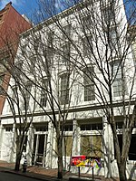
Camp Street, New Orleans Storyville

Geographical coordinates (GPS) Address Website Nearby Places
placeShow on map

Wikipedia: Trump International Hotel and Tower (New Orleans)Continue reading on Wikipedia

Geographical coordinates (GPS)

Latitude Longitude
N 29.9493 ° E -90.0684 °
placeShow on map

Address

Premium Parking Lot P296

Camp Street 408
70130 New Orleans, Storyville
Louisiana, United States
mapOpen on Google Maps

Website
premiumparking.com

linkVisit website

Share experience

Nearby Places

Lafayette Square (New Orleans)

Lafayette Square is the second-oldest public park in New Orleans, Louisiana (after Jackson Square), located in the present-day Central Business District. During the late 18th century, this was part of a residential area called Faubourg Sainte Marie (English: St. Mary Suburb). The park was designed in 1788 by Charles Laveau Trudeau aka Don Carlos Trudeau (1743–1816), Surveyor General of Louisiana under the Spanish government; who later served as New Orleans' acting mayor in 1812, after Louisiana statehood. The Square was named after Gilbert du Motier, Marquis de Lafayette, a French aristocrat and general who fought on the American side in the American Revolutionary War. The park has a bronze statue of Henry Clay in the center of the park and a statue of Benjamin Franklin on Camp Street. A statue of John McDonogh on St. Charles Avenue was removed in July 2020.Gallier Hall, the former City Hall of New Orleans faces the square on St. Charles Avenue. Although the city government has moved elsewhere, the square is still used for inaugurations and civic events. The square also often hosts live music. From 1834 to 1938 First Presbyterian Church of New Orleans occupied much of the Western side of the square and was the tallest steeple in the city. It was from this steeple that General Benjamin Butler used the bell to ring curfew during the occupation of New Orleans (1862–65) during the American Civil War. Most of the architectural elements (including the bell) were moved to First Presbyterian's subsequent location at the corner of South Claiborne and Jefferson Avenues in New Orleans. Hurricane Katrina severely damaged the trees in the park, with broken glass and debris from nearby buildings making the park unsafe. A group of neighborhood residents and downtown workers formed a charitable organization, the Lafayette Square Conservancy, to transform it into a premier urban space.