Berkley Common Historic District
Berkley, MassachusettsBristol County, Massachusetts Registered Historic Place stubsHistoric districts in Bristol County, MassachusettsHistoric districts on the National Register of Historic Places in MassachusettsNRHP infobox with nocat ... and 2 more
National Register of Historic Places in Bristol County, MassachusettsUse mdy dates from August 2023

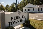
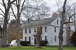
The Berkley Common Historic District is a historic district encompassing the historic heart of Berkley, Massachusetts. The town's village center is located near its geographic center, roughly midway between Massachusetts Route 24 and the Taunton River. Its central focus is the triangular town common, bounded by Main, Locust, and Porter Streets. The common is flanked by a number municipal and civic buildings, and has been the town's focus of civic life for more about 275 years.The district was added to the National Register of Historic Places in 2016.
Excerpt from the Wikipedia article Berkley Common Historic District (License: CC BY-SA 3.0, Authors, Images).Berkley Common Historic District
Porter Street,
Geographical coordinates (GPS) Address Nearby Places Show on map
Geographical coordinates (GPS)
| Latitude | Longitude |
|---|---|
| N 41.846111111111 ° | E -71.081944444444 ° |
Address
Town Common
Porter Street
02779
Massachusetts, United States
Open on Google Maps
