Siege of Sluis (1604)

The siege of Sluis (1604), also known as the Sluis campaign or the Battle of the Oostburg Line, was a series of military actions that took place during the Eighty Years' War and the Anglo–Spanish War from 19 May to 19 August 1604. A States and English army under Prince Maurice of Orange and Horace Vere respectively crossed the Scheldt estuary and advanced on land taking Cadzand, Aardenburg, and IJzendijke in the Spanish Netherlands. This soon led to the culmination of the siege of the Spanish-held inland port of Sluis.Initially it was hoped that with Ostend under siege for three years by the Spanish, an attempted relief by Maurice's army could be achieved. Even though Ostend would finally fall into the hands of the Spanish, Sluis, an important stronghold itself, was eventually captured after tough fighting which included the defeat of a Spanish relief force under Ambrogio Spinola and Luis de Velasco.
Excerpt from the Wikipedia article Siege of Sluis (1604) (License: CC BY-SA 3.0, Authors, Images).Siege of Sluis (1604)
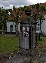
Voogdtstraat, Sluis
Geographical coordinates (GPS) Address Nearby Places Show on map
Geographical coordinates (GPS)
| Latitude | Longitude |
|---|---|
| N 51.308333333333 ° | E 3.3861111111111 ° |
Address
Vesting Sluis
Voogdtstraat
4524 MC Sluis
Zeeland, Netherlands
Open on Google Maps


